File:Carte du Conseil de l'Europe.png
Jump to navigation
Jump to search
Size of this preview: 784 × 600 pixels. Other resolutions: 314 × 240 pixels | 628 × 480 pixels | 1,004 × 768 pixels | 1,200 × 918 pixels.
Original file (1,200 × 918 pixels, file size: 284 KB, MIME type: image/png)
Captions
Captions
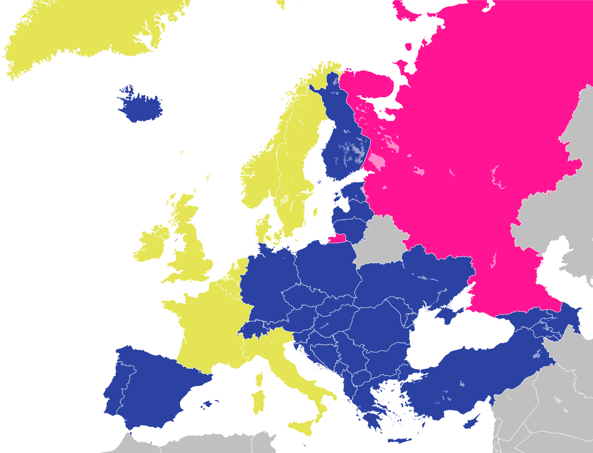
Map of the Council of Europe member states by founding members, later members and former members.

|
File:Map of Council of Europe member states by founding and later members.svg is a vector version of this file. It should be used in place of this PNG file when not inferior.
File:Carte du Conseil de l'Europe.png → File:Map of Council of Europe member states by founding and later members.svg
For more information, see Help:SVG. |
 |
Summary
[edit]
| Description | |
| Date | |
| Source | Own work by uploader, based on Image:Euro 2008.png |
| Author | JLogan |
Licensing
[edit]
I, the copyright holder of this work, hereby publish it under the following licenses:
This file is licensed under the Creative Commons Attribution-Share Alike 3.0 Unported license.
- You are free:
- to share – to copy, distribute and transmit the work
- to remix – to adapt the work
- Under the following conditions:
- attribution – You must give appropriate credit, provide a link to the license, and indicate if changes were made. You may do so in any reasonable manner, but not in any way that suggests the licensor endorses you or your use.
- share alike – If you remix, transform, or build upon the material, you must distribute your contributions under the same or compatible license as the original.

|
Permission is granted to copy, distribute and/or modify this document under the terms of the GNU Free Documentation License, Version 1.2 or any later version published by the Free Software Foundation; with no Invariant Sections, no Front-Cover Texts, and no Back-Cover Texts. A copy of the license is included in the section entitled GNU Free Documentation License. |
You may select the license of your choice.
File history
Click on a date/time to view the file as it appeared at that time.
| Date/Time | Thumbnail | Dimensions | User | Comment | |
|---|---|---|---|---|---|
| current | 17:50, 11 March 2022 | | 1,200 × 918 (284 KB) | Sbb1413 (talk | contribs) | Update. |
| 13:19, 1 October 2020 |  | 1,200 × 1,000 (38 KB) | Super Dromaeosaurus (talk | contribs) | Added Isle of Man, Guernsey and Jersey | |
| 04:49, 6 January 2015 |  | 1,200 × 1,000 (52 KB) | Jurryaany (talk | contribs) | Fixed German sovereignty over Borkum. | |
| 03:52, 14 November 2013 |  | 1,200 × 1,000 (48 KB) | Che829 (talk | contribs) | Reverted to version as of 21:36, 19 August 2008 - Nonfactual unsupported claim as per official documents published by CoE (Founders are only the 10 original signatories of w:Treaty of London (1949) on 5 May 1949 at St. James's Palace in London http... | |
| 21:27, 13 February 2009 |  | 1,200 × 1,000 (43 KB) | Emturan (talk | contribs) | Greece and Turkey are striped to show their founder member status while they joined to Council of Europe later. | |
| 21:36, 19 August 2008 |  | 1,200 × 1,000 (48 KB) | JLogan (talk | contribs) | {{Information |Description={{en|1=Map of the Council of Europe.<br />{{legend|#e4e454|Founder}}{{legend|#2b42a3|Later member}}}} {{fr|1=Carte du Conseil de l'Europe.<br />{{legend|#e4e454|Fondateurs}}{{legend|#2b42a3|Autres}}}} | |
You cannot overwrite this file.
File usage on Commons
The following 3 pages use this file:
File usage on other wikis
The following other wikis use this file:
- Usage on en.wikipedia.org
- Usage on fr.wikipedia.org
- Usage on hy.wikipedia.org
- Usage on ja.wikipedia.org
- Usage on ru.wikipedia.org