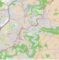
File:Carte de la commune de Fribourg (Suisse).svg
From Wikimedia Commons, the free media repository
Jump to navigation
Jump to search

Size of this PNG preview of this SVG file: 589 × 599 pixels. Other resolutions: 236 × 240 pixels | 472 × 480 pixels | 755 × 768 pixels | 1,006 × 1,024 pixels | 2,013 × 2,048 pixels | 970 × 987 pixels.
Original file (SVG file, nominally 970 × 987 pixels, file size: 1.04 MB)
File information
Structured data
Captions
Captions
Add a one-line explanation of what this file represents
Summary
[edit]| DescriptionCarte de la commune de Fribourg (Suisse).svg |
Français : Carte de la commune de Fribourg (Suisse)
Échelle : 1:20000 English: Map of Fribourg (Switzerland)
Scale : 1:20000 |
| Date | |
| Source | OpenStreetMap.org |
| Author | Lloyd |
| Camera location | 46° 48′ 21.97″ N, 7° 09′ 45.99″ E | View this and other nearby images on: OpenStreetMap |
|---|
Geographic limits of the map:
- Left : 7.1286
- Right : 7.1896
- Top : 46.8244
- Bottom : 46.7819
Licensing
[edit]
|
This work is licensed under the Open Database License (summary).Open Database LicenseODbLhttp://opendatacommons.org/licenses/odbl/1.0/true |
File history
Click on a date/time to view the file as it appeared at that time.
| Date/Time | Thumbnail | Dimensions | User | Comment | |
|---|---|---|---|---|---|
| current | 08:14, 11 June 2013 |  | 970 × 987 (1.04 MB) | Quadrien (talk | contribs) | Fichier allégé et encore simplifié... |
| 08:53, 10 June 2013 |  | 970 × 987 (2.11 MB) | Quadrien (talk | contribs) | Simplification des couleurs et mise en valeur de la commune de Fribourg uniquement. | |
| 08:40, 10 June 2013 |  | 1,213 × 1,234 (3.91 MB) | Quadrien (talk | contribs) | Reverted to version as of 06:23, 10 June 2013 | |
| 08:39, 10 June 2013 |  | 970 × 987 (3.59 MB) | Quadrien (talk | contribs) | Simplification des couleurs de la carte | |
| 06:23, 10 June 2013 |  | 1,213 × 1,234 (3.91 MB) | Quadrien (talk | contribs) | User created page with UploadWizard |
You cannot overwrite this file.
File usage on Commons
There are no pages that use this file.
File usage on other wikis
The following other wikis use this file:
- Usage on fr.wikipedia.org
- Eikon
- Pont de Berne
- Barrage de la Maigrauge
- Pont de Saint-Jean
- BCF-Arena
- Pont de la Poya
- Fri Art Kunsthalle
- Gare de Fribourg
- Schoenberg (ville de Fribourg)
- Le Bourg (ville de Fribourg)
- Modèle:Géolocalisation/Fribourg (Suisse)
- Modèle:Carte/Fribourg (Suisse)
- Wikipédia:Atelier graphique/Cartes/Archives/juin 2013
- Pérolles (ville de Fribourg)
Metadata
This file contains additional information such as Exif metadata which may have been added by the digital camera, scanner, or software program used to create or digitize it. If the file has been modified from its original state, some details such as the timestamp may not fully reflect those of the original file. The timestamp is only as accurate as the clock in the camera, and it may be completely wrong.
| Width | 970px |
|---|---|
| Height | 987px |