File:Carte de la Republique de L'Amerique Centrale.jpg
Original file (2,576 × 1,690 pixels, file size: 1.46 MB, MIME type: image/jpeg)
Captions
Captions
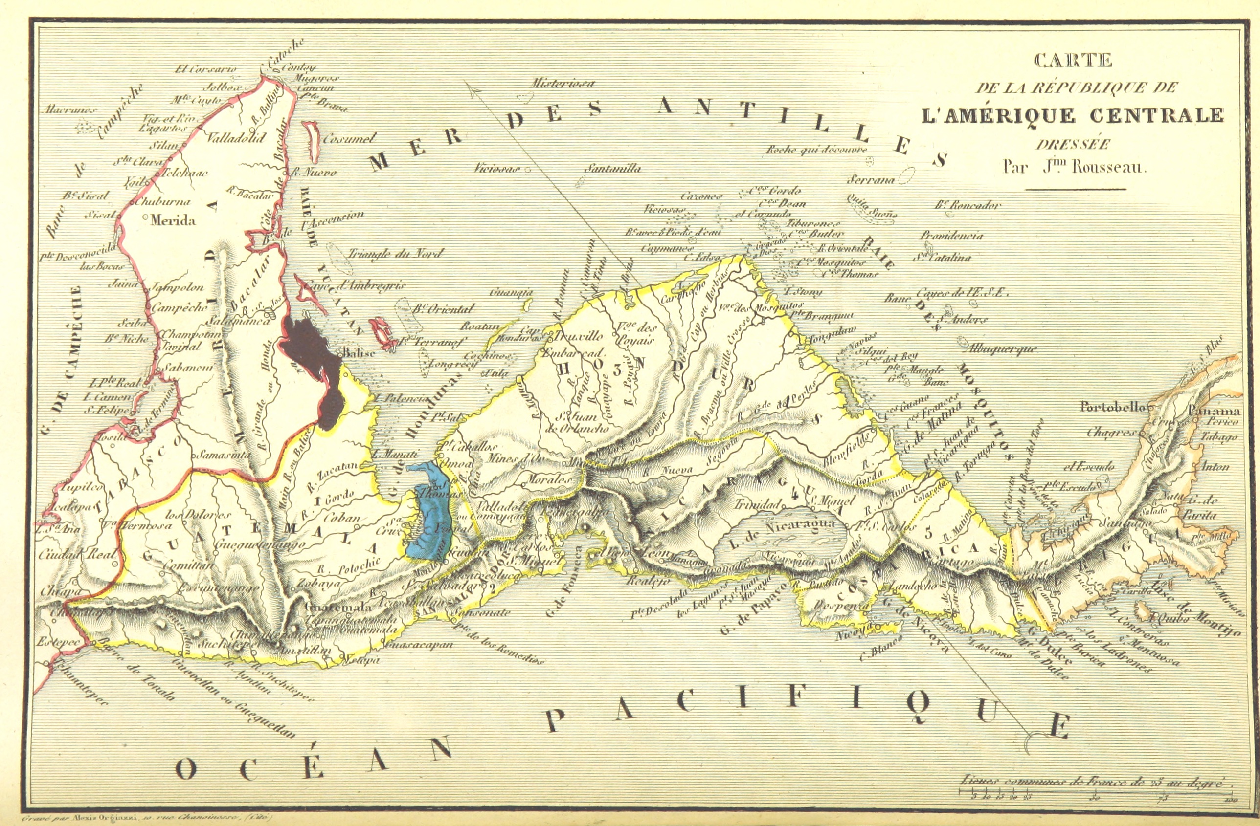
| Date | 1844 | ||||
| Accession number |
British Library HMNTS 10480.e.21. |
||||
| Source/Photographer |
Image extracted from page 58 of Amérique centrale. Colonisation du district de Santo-Thomas de Guatemala par la Communauté de l'Union, fondée par la Compagnie Belge de Colonisation. Collection de renseignements publiés ou recueillis par la Compagnie …, by N.N.. Original held and digitised by the British Library. Copied from Flickr. Note: The colours, contrast and appearance of these illustrations are unlikely to be true to life. They are derived from scanned images that have been enhanced for machine interpretation and have been altered from their originals.
|
||||
| Permission (Reusing this file) |
|
||||

File history
Click on a date/time to view the file as it appeared at that time.
| Date/Time | Thumbnail | Dimensions | User | Comment | |
|---|---|---|---|---|---|
| current | 19:41, 11 February 2014 | | 2,576 × 1,690 (1.46 MB) | Metilsteiner (talk | contribs) | User created page with UploadWizard |
You cannot overwrite this file.
File usage on Commons
The following page uses this file:
File usage on other wikis
The following other wikis use this file:
- Usage on af.wikipedia.org
- Usage on de.wikipedia.org
- Usage on es.wikipedia.org
- Usage on lv.wikipedia.org
- Usage on pl.wikipedia.org
- Usage on ru.wikipedia.org
- Usage on sh.wikipedia.org
- Maps from the Mechanical Curator collection
- Maps from the Mechanical Curator collection available to georeference
- Colonisation du district de Santo-Thomas de Guatemala (1844) by Compagnie Belge de Colonisation
- Maps of the history of colonies of Belgium
- 1840s maps of Costa Rica
- 1840s maps of Central America
- Maps of the Federal Republic of Central America