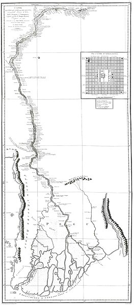
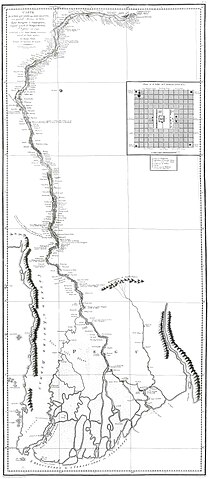
File:Carte de l'Irraouaddy. Dessinée en 1795, par Thomas Wood. In relation de l'Ambassade anglaise envoyée dans le royaume d'Ava, par la major Michel Symes.Paris, Buisson, AN IX (1800).jpg
Jump to navigation
Jump to search

Size of this preview: 263 × 600 pixels. Other resolutions: 105 × 240 pixels | 210 × 480 pixels | 337 × 768 pixels | 449 × 1,024 pixels | 898 × 2,048 pixels | 4,000 × 9,121 pixels.
Original file (4,000 × 9,121 pixels, file size: 1.87 MB, MIME type: image/jpeg)
Captions
Captions
Add a one-line explanation of what this file represents
Summary
[edit].jpg&action=edit§ion=1)
| Description |
Français : carte du fleuve Irrawaddy en 1792, avec description des villes et villages. Tirée de l'Atlas de la relation de l'Ambassade anglaise dans le royaume d'Ava, en 1795 |
| Date | |
| Source | Own work |
| Author | Victorcouto |
Licensing
[edit].jpg&action=edit§ion=2)
| I, the copyright holder of this work, release this work into the public domain. This applies worldwide. In some countries this may not be legally possible; if so: I grant anyone the right to use this work for any purpose, without any conditions, unless such conditions are required by law. |
File history
Click on a date/time to view the file as it appeared at that time.
| Date/Time | Thumbnail | Dimensions | User | Comment | |
|---|---|---|---|---|---|
| current | 11:42, 4 December 2009 | | 4,000 × 9,121 (1.87 MB) | Victorcouto (talk | contribs) | {{Information |Description={{fr|1=carte du fleuve Irrawaddy en 1792, avec description des villes et villages. Tirée de l'Atlas de la relation de l'Ambassade anglaise dans le royaume d'Ava, en 1795}} |Source={{own}} |Author=[[User:Victorcouto|Victorcouto] |
You cannot overwrite this file.
File usage on Commons
There are no pages that use this file.
File usage on other wikis
The following other wikis use this file:
- Usage on pt.wikipedia.org
.jpg&oldid=849203628)