File:Carte comprenant la Riviere et le Lac Saint-Pierre et la ville de Montreal.jpg
Jump to navigation
Jump to search
Size of this preview: 800 × 356 pixels. Other resolutions: 320 × 142 pixels | 640 × 285 pixels | 1,024 × 455 pixels | 1,280 × 569 pixels | 2,560 × 1,138 pixels | 5,101 × 2,268 pixels.
Original file (5,101 × 2,268 pixels, file size: 1.78 MB, MIME type: image/jpeg)
Captions
Captions
Add a one-line explanation of what this file represents
Summary
[edit]
| Description |
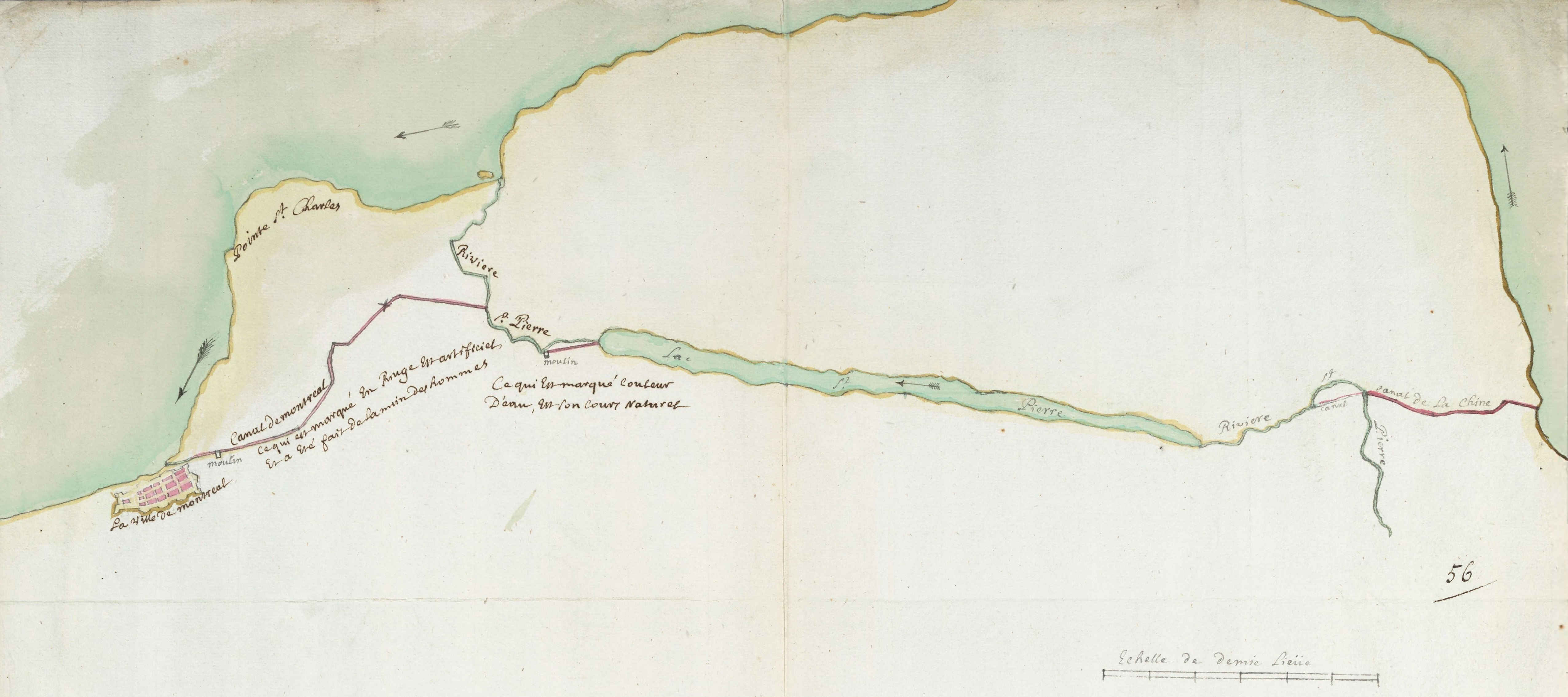
Français : Plan sommaire dessiné par François Chèze; canaux et moulins; indication du cours du fleuve. Echelle 9,3 cm pour 1/2 lieue [1/24 000e] Dessin à la plume aquarellé sur papier 41 x 53,3 |
| Date | |
| Source | anom.archivesnationales.culture.gouv.fr |
| Author | François Chèze |
| Other versions |
 |
Licensing
[edit]
|
This work is in the public domain in its country of origin and other countries and areas where the copyright term is the author's life plus 70 years or fewer. This work is in the public domain in the United States because it was published (or registered with the U.S. Copyright Office) before January 1, 1929. | |
| This file has been identified as being free of known restrictions under copyright law, including all related and neighboring rights. | |
File history
Click on a date/time to view the file as it appeared at that time.
| Date/Time | Thumbnail | Dimensions | User | Comment | |
|---|---|---|---|---|---|
| current | 20:08, 8 November 2015 | | 5,101 × 2,268 (1.78 MB) | Jeangagnon (talk | contribs) | ajout |
| 21:21, 7 November 2015 |  | 4,788 × 2,268 (1.66 MB) | Jeangagnon (talk | contribs) | ajout | |
| 02:08, 7 November 2015 |  | 2,553 × 1,825 (776 KB) | Jeangagnon (talk | contribs) | User created page with UploadWizard |
You cannot overwrite this file.
File usage on Commons
The following page uses this file: