File:Carte Transilien Ligne P (2002).svg
Jump to navigation
Jump to search

Size of this PNG preview of this SVG file: 575 × 510 pixels. Other resolutions: 271 × 240 pixels | 541 × 480 pixels | 866 × 768 pixels | 1,155 × 1,024 pixels | 2,309 × 2,048 pixels.
Original file (SVG file, nominally 575 × 510 pixels, file size: 340 KB)
Captions
Captions
Add a one-line explanation of what this file represents
Summary
[edit].svg&action=edit§ion=1)
| Description |
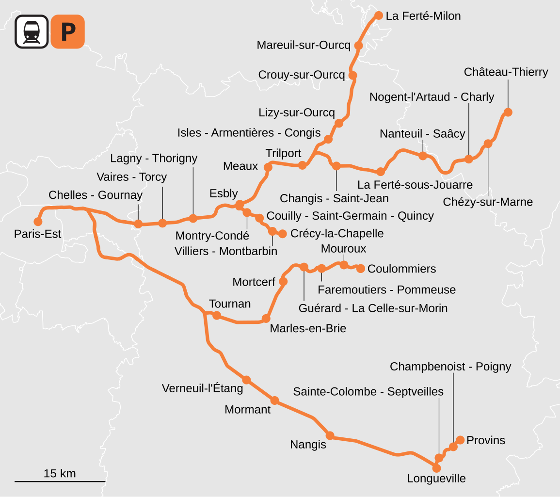
Français : Tracé réel de la ligne P du Transilien. |
| Date | |
| Source | Own work |
| Author | Chabe01 |
Licensing
[edit].svg&action=edit§ion=2)
I, the copyright holder of this work, hereby publish it under the following license:
This file is licensed under the Creative Commons Attribution-Share Alike 4.0 International license.
- You are free:
- to share – to copy, distribute and transmit the work
- to remix – to adapt the work
- Under the following conditions:
- attribution – You must give appropriate credit, provide a link to the license, and indicate if changes were made. You may do so in any reasonable manner, but not in any way that suggests the licensor endorses you or your use.
- share alike – If you remix, transform, or build upon the material, you must distribute your contributions under the same or compatible license as the original.
File history
Click on a date/time to view the file as it appeared at that time.
| Date/Time | Thumbnail | Dimensions | User | Comment | |
|---|---|---|---|---|---|
| current | 22:56, 20 December 2021 | | 575 × 510 (340 KB) | Chabe01 (talk | contribs) | Fichier allégé et charte graphique plus proche des cartes de lignes de métro |
| 22:35, 1 December 2021 |  | 685 × 520 (413 KB) | Chabe01 (talk | contribs) | Uploaded own work with UploadWizard |
You cannot overwrite this file.
File usage on Commons
The following 6 pages use this file:
- User:Chumwa/OgreBot/Public transport information/2021 December 1-10
- User:Chumwa/OgreBot/Public transport information/2021 December 11-20
- User:Chumwa/OgreBot/Transport Maps/2021 December 1-10
- User:Chumwa/OgreBot/Transport Maps/2021 December 11-20
- Category:Maps of Transilien Line P
- Category:Transilien Line P
File usage on other wikis
The following other wikis use this file:
- Usage on fr.wikipedia.org
- Usage on www.wikidata.org
.svg&oldid=849185099)