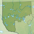
File:Carte Abitibi-Témiscamingue.png
From Wikimedia Commons, the free media repository
Jump to navigation
Jump to search

Size of this preview: 542 × 600 pixels. Other resolutions: 217 × 240 pixels | 434 × 480 pixels.
Original file (800 × 885 pixels, file size: 995 KB, MIME type: image/png)
File information
Structured data
Captions
Captions
Add a one-line explanation of what this file represents
Summary
[edit]| DescriptionCarte Abitibi-Témiscamingue.png |
Français : Carte de localisation de la région administrative d'Abitibi-Temiscamingue |
| Date | |
| Source |
 |
| Author | Carport, YanikB |
Licensing
[edit]This file is licensed under the Creative Commons Attribution-Share Alike 4.0 International license.
- You are free:
- to share – to copy, distribute and transmit the work
- to remix – to adapt the work
- Under the following conditions:
- attribution – You must give appropriate credit, provide a link to the license, and indicate if changes were made. You may do so in any reasonable manner, but not in any way that suggests the licensor endorses you or your use.
- share alike – If you remix, transform, or build upon the material, you must distribute your contributions under the same or compatible license as the original.
File history
Click on a date/time to view the file as it appeared at that time.
| Date/Time | Thumbnail | Dimensions | User | Comment | |
|---|---|---|---|---|---|
| current | 14:38, 22 October 2018 |  | 800 × 885 (995 KB) | YanikB (talk | contribs) | Reverted to version as of 22:33, 17 October 2018 (UTC) |
| 14:38, 22 October 2018 |  | 800 × 796 (496 KB) | YanikB (talk | contribs) | Reverted to version as of 15:12, 19 March 2018 (UTC) | |
| 22:33, 17 October 2018 |  | 800 × 885 (995 KB) | YanikB (talk | contribs) | +MRC borders | |
| 15:12, 19 March 2018 |  | 800 × 796 (496 KB) | YanikB (talk | contribs) | +resolution | |
| 14:40, 19 March 2018 |  | 222 × 218 (75 KB) | YanikB (talk | contribs) | align | |
| 20:28, 18 March 2018 |  | 800 × 764 (518 KB) | YanikB (talk | contribs) | User created page with UploadWizard |
You cannot overwrite this file.
File usage on Commons
The following page uses this file:
- File:Carte Abitibi-Temiscamingue.png (file redirect)
File usage on other wikis
The following other wikis use this file:
- Usage on fr.wikipedia.org
- Senneterre (ville)
- Laverlochère (Québec)
- Lac Abitibi
- Lac Témiscamingue
- Aréna Glencore
- Winneway
- Kitcisakik
- Lac Dumoine
- Lac Parent (Abitibi)
- Lac Duparquet
- Centre Agnico Eagle
- Grand lac Victoria
- Lac Cawasachouane
- Lac Malartic
- Hunter's Point
- Cadillac (Québec)
- Arntfield
- Réservoir Dozois
- Cléricy (Rouyn-Noranda)
- D'Alembert (Québec)
- Destor
- Montbeillard (Rouyn-Noranda)
- Mont-Brun
- McWatters
- Évain (Québec)
- Réservoir Decelles
- Lac Simard (Témiscamingue)
- Lac Opasatica
- Lac Barrière (Rouyn-Noranda)
- Lac Macamic
- Lac Beauchêne
- Lac la Cave
- Fossilarium de Notre-Dame-du-Nord
- Lac Allard
- Lac Ostaboningue
- Lac Capitachouane
- Lac Camachigama
- Lac Bouchette (rivière des Outaouais)
- Lac Pikianikijuan
- Lac Sabourin (Abitibi-Témiscamingue)
- Lac Tiblemont
- Lac Berthelot (rivière Mégiscane)
- Bernetz (canton)
- Lac Blouin
- Lac De Montigny
- Lac Castagnier
- Lac Chassignolle
- Lac Cadillac
- Lac Bruyère
- Lac Beauchastel
View more global usage of this file.
Metadata
This file contains additional information such as Exif metadata which may have been added by the digital camera, scanner, or software program used to create or digitize it. If the file has been modified from its original state, some details such as the timestamp may not fully reflect those of the original file. The timestamp is only as accurate as the clock in the camera, and it may be completely wrong.
| Software used |
|---|