File:Carta Corografica Del Estado De Bolivar.jpg
Jump to navigation
Jump to search

Size of this preview: 486 × 599 pixels. Other resolutions: 194 × 240 pixels | 389 × 480 pixels | 623 × 768 pixels | 830 × 1,024 pixels | 1,660 × 2,048 pixels | 6,620 × 8,165 pixels.
Original file (6,620 × 8,165 pixels, file size: 14.52 MB, MIME type: image/jpeg)
Captions
Captions
Add a one-line explanation of what this file represents
Summary
[edit]
| Description |
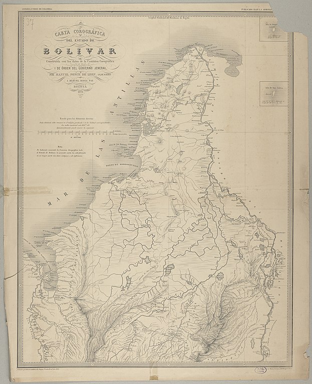
Deutsch: 1 Kt. : unkolor. (48 x 63 cm); Koordinaten W 77°10'00"-W 73°42'00"/N 11°43'00"-N 6°54'00"; Maßstab in graph. Form (milla exuatorial). - Titel unten rechts. - Mit 2 Nebenkt.: Isla de San Andres & Isla de Providencia. - Oben links: Estados Unidos De Colombia. - Eventuell aus: Mosquera, T. C. de, Compendio de geografia general política, física y especial de los Estados Unidos de Colombia, 1886. - Relief: Gebirge in Schraffen |
| Date | |
| Source | Leibniz-Institut für Länderkunde, Leipzig |
| Author | Ponce de León, Manuel (Hrsg.) |
Topographische Karte der Provinz Bolivar sowie der Inseln San Andrés und Providencia
Licensing
[edit]
| This file is made available under the Creative Commons CC0 1.0 Universal Public Domain Dedication. | |
| The person who associated a work with this deed has dedicated the work to the public domain by waiving all of their rights to the work worldwide under copyright law, including all related and neighboring rights, to the extent allowed by law. You can copy, modify, distribute and perform the work, even for commercial purposes, all without asking permission.
|
File history
Click on a date/time to view the file as it appeared at that time.
| Date/Time | Thumbnail | Dimensions | User | Comment | |
|---|---|---|---|---|---|
| current | 11:24, 5 September 2018 | | 6,620 × 8,165 (14.52 MB) | Higgenhorscht (talk | contribs) | User created page with UploadWizard |
You cannot overwrite this file.
File usage on Commons
There are no pages that use this file.
File usage on other wikis
The following other wikis use this file:
- Usage on en.wikipedia.org
- Usage on es.wikipedia.org
- Usage on fr.wikipedia.org