File:Carpathians satellite.jpg
Jump to navigation
Jump to search
Size of this preview: 463 × 599 pixels. Other resolutions: 185 × 240 pixels | 371 × 480 pixels | 593 × 768 pixels | 791 × 1,024 pixels | 1,582 × 2,048 pixels | 3,400 × 4,400 pixels.
Original file (3,400 × 4,400 pixels, file size: 2.95 MB, MIME type: image/jpeg)
Captions
Captions
Add a one-line explanation of what this file represents
Summary
[edit]
| Description |
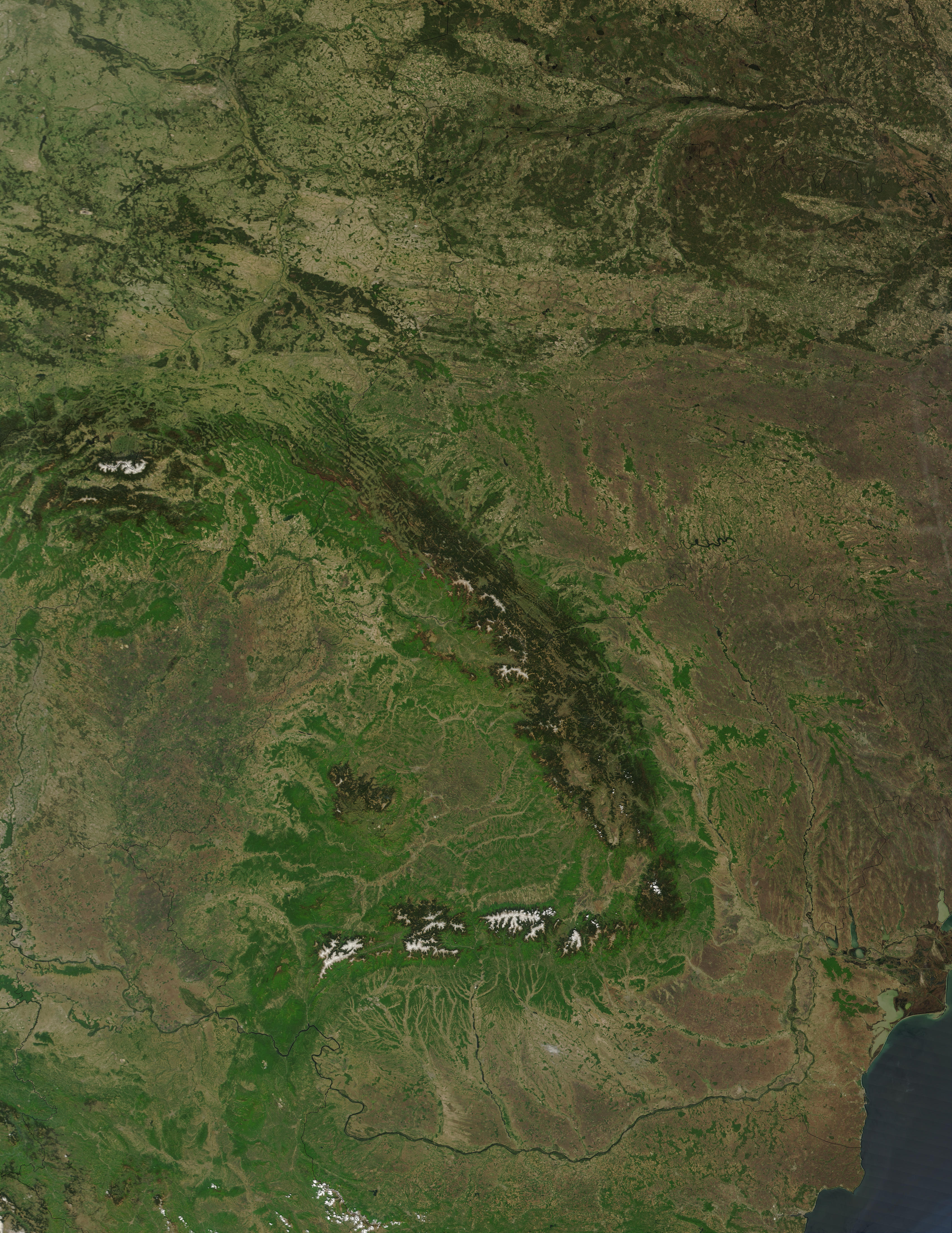
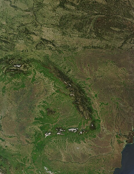
English: Carpathian Mountains satellite image |
| Source | Visible Earth page of NASA: http://visibleearth.nasa.gov/view_detail.php?id=5348 |
| Author | NASA |
Licensing
[edit]
| This file is in the public domain in the United States because it was solely created by NASA. NASA copyright policy states that "NASA material is not protected by copyright unless noted". (See Template:PD-USGov, NASA copyright policy page or JPL Image Use Policy.) | ||
 |
Warnings:
|
File history
Click on a date/time to view the file as it appeared at that time.
| Date/Time | Thumbnail | Dimensions | User | Comment | |
|---|---|---|---|---|---|
| current | 11:46, 30 August 2009 | | 3,400 × 4,400 (2.95 MB) | Qorilla (talk | contribs) | {{Information |Description={{en|1=Carpathian Mountains satellite image}} |Source=Visible Earth page of NASA: http://visibleearth.nasa.gov/view_detail.php?id=5348 |Author=NASA |Date= |Permission= |other_versions= }} Category:Carpathian Mountains [[Cat |
You cannot overwrite this file.
File usage on Commons
There are no pages that use this file.
File usage on other wikis
The following other wikis use this file:
- Usage on es.wikipedia.org
- Usage on hu.wikipedia.org
- Usage on sc.wikipedia.org
- Usage on tr.wikipedia.org