File:Carnegie Arch.jpg
Jump to navigation
Jump to search

Size of this preview: 450 × 600 pixels. Other resolutions: 180 × 240 pixels | 360 × 480 pixels | 576 × 768 pixels | 768 × 1,024 pixels | 1,699 × 2,265 pixels.
Original file (1,699 × 2,265 pixels, file size: 698 KB, MIME type: image/jpeg)
Captions
Captions
Add a one-line explanation of what this file represents
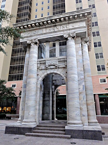
| Description | Carnegie Monument, an arch in Atlanta | ||
| Date | |||
| Source | Flickr: Arch of Learning | ||
| Author | Bart Everson | ||
| Permission (Reusing this file) |
This file is licensed under the Creative Commons Attribution 2.0 Generic license.
|
| Camera location | | View this and other nearby images on: OpenStreetMap |
|---|
File history
Click on a date/time to view the file as it appeared at that time.
| Date/Time | Thumbnail | Dimensions | User | Comment | |
|---|---|---|---|---|---|
| current | 01:05, 10 November 2011 | | 1,699 × 2,265 (698 KB) | Flickr upload bot (talk | contribs) | Uploaded from http://flickr.com/photo/11018968@N00/6307540381 using Flickr upload bot |
You cannot overwrite this file.
File usage on Commons
The following page uses this file:
File usage on other wikis
The following other wikis use this file:
- Usage on en.wikipedia.org
- Usage on www.wikidata.org
- Usage on zh.wikipedia.org