File:Cape Smokey Provincial Park.jpg
Jump to navigation
Jump to search

Size of this preview: 800 × 240 pixels. Other resolutions: 640 × 192 pixels | 1,024 × 307 pixels | 1,280 × 384 pixels | 2,560 × 767 pixels | 8,784 × 2,633 pixels.
Original file (8,784 × 2,633 pixels, file size: 11.06 MB, MIME type: image/jpeg)
Captions
Captions
Add a one-line explanation of what this file represents
Summary
[edit]
| Description |
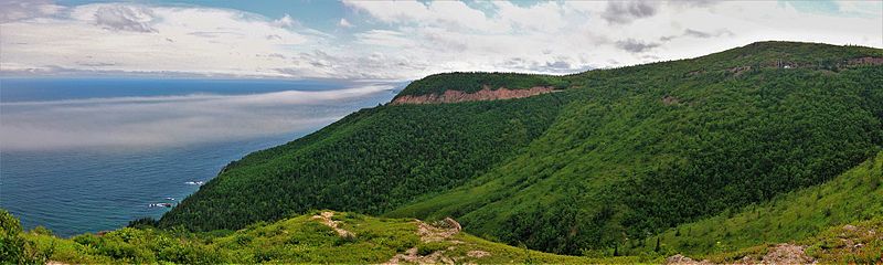
English: View of Cabot Trail winding along the Atlantic Coast of Cape Breton Nova Scotia.
English: Cape Smokey Provincial Park |
||
| Date | |||
| Source | Own work | ||
| Author | LPeezy |
Licensing
[edit]
I, the copyright holder of this work, hereby publish it under the following license:
This file is licensed under the Creative Commons Attribution-Share Alike 4.0 International license.
- You are free:
- to share – to copy, distribute and transmit the work
- to remix – to adapt the work
- Under the following conditions:
- attribution – You must give appropriate credit, provide a link to the license, and indicate if changes were made. You may do so in any reasonable manner, but not in any way that suggests the licensor endorses you or your use.
- share alike – If you remix, transform, or build upon the material, you must distribute your contributions under the same or compatible license as the original.
This image was uploaded as part of Wiki Loves Earth 2017.
|
 |
File history
Click on a date/time to view the file as it appeared at that time.
| Date/Time | Thumbnail | Dimensions | User | Comment | |
|---|---|---|---|---|---|
| current | 01:35, 8 June 2017 | 8,784 × 2,633 (11.06 MB) | LPeezy (talk | contribs) | User created page with UploadWizard |
You cannot overwrite this file.
File usage on Commons
The following page uses this file:
File usage on other wikis
The following other wikis use this file:
- Usage on ceb.wikipedia.org
- Usage on en.wikipedia.org
- Usage on en.wikivoyage.org
- Usage on fr.wikipedia.org
- Usage on www.wikidata.org