File:Cape Elizabeth Light (15123584995).jpg

Original file (1,400 × 958 pixels, file size: 793 KB, MIME type: image/jpeg)
Captions
Captions
Summary
[edit].jpg&action=edit§ion=1)
| Description |
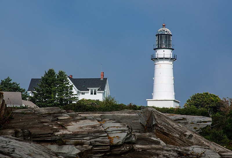
I took this on a foggy Monday morning. The fog at this time was more dense over the water and had begun to dissipate around the lighthouse. The area is known as "Two Lights" due to the history of the station. It was originally built in 1828 as two rubble stone towers 300 yards (270 m) apart. Steam-driven warning whistles were installed in the twin towers in 1869, the first used in North America. In 1874, both structures were replaced by conical towers made of cast-iron, each 67 feet (20 m) high and 129 feet (39 m) above sea level. Despite its twin beacons, Cape Elizabeth witnessed many shipwrecks. In January 1885, during a raging snowstorm, keeper Marcus A. Hanna made a daring rescue of two seamen from the schooner Australia, which had run aground on a nearby ledge. The use of multiple lights in a given site was discontinued in 1924. The western light was removed from service, and eventually sold to a private party in the 1970s. The eastern tower remains in service as "Cape Elizabeth Light." Two Lights State Park is a state park located on Cape Elizabeth, Maine, named after the twin Cape Elizabeth Lights. The 41-acre (17 ha) park opened in 1961 and offers views of Casco Bay and the Atlantic Ocean. In addition to rocky headlands, the park includes the still-active easternmost Cape Elizabeth Light, the remains of a World War II-era seacoast battery bunker, and a fire control tower. The park's twin lighthouses were built in 1828. One is still active, the other was decommissioned in 1924 and is now a private home. Edward Hopper made one of the towers the subject of his 1929 painting The Lighthouse at Two Lights. |
| Date | |
| Source | Cape Elizabeth Light |
| Author | Paul VanDerWerf from Brunswick, Maine, USA |
| Camera location | | View this and other nearby images on: OpenStreetMap |
|---|
.jpg¶ms=043.564456_N_-070.198302_E_globe:Earth_type:camera_source:Flickr_&language=en)
Licensing
[edit].jpg&action=edit§ion=2)
- You are free:
- to share – to copy, distribute and transmit the work
- to remix – to adapt the work
- Under the following conditions:
- attribution – You must give appropriate credit, provide a link to the license, and indicate if changes were made. You may do so in any reasonable manner, but not in any way that suggests the licensor endorses you or your use.
| This image was originally posted to Flickr by Me in ME at https://flickr.com/photos/12357841@N02/15123584995 (archive). It was reviewed on 11 July 2018 by FlickreviewR 2 and was confirmed to be licensed under the terms of the cc-by-2.0. |
File history
Click on a date/time to view the file as it appeared at that time.
| Date/Time | Thumbnail | Dimensions | User | Comment | |
|---|---|---|---|---|---|
| current | 22:30, 11 July 2018 | | 1,400 × 958 (793 KB) | Hiàn (alt) (talk | contribs) | Transferred from Flickr via #flickr2commons |
You cannot overwrite this file.
File usage on Commons
There are no pages that use this file.
.jpg&oldid=847660118)