File:Canadian Postal Code Map.png
Jump to navigation
Jump to search
Size of this preview: 708 × 599 pixels. Other resolutions: 284 × 240 pixels | 567 × 480 pixels | 924 × 782 pixels.
Original file (924 × 782 pixels, file size: 55 KB, MIME type: image/png)
Captions
Captions
Add a one-line explanation of what this file represents

|
File:Canadian postal district map.svg is a vector version of this file. It should be used in place of this PNG file when not inferior.
File:Canadian Postal Code Map.png → File:Canadian postal district map.svg
For more information, see Help:SVG. |
 |
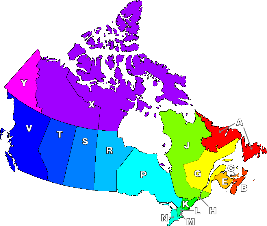
| Description | Codes postaux canadiens | ||
| Date | |||
| Source | http://en.wikipedia.org/wiki/Image:Canadian_Postal_Code_Map.png | ||
| Author | Denelson83 | ||
| Permission (Reusing this file) |
|
Original upload log
[edit]
- 01:08, 5 January 2005 . . Denelson83 . . 924×782 (56,201 bytes) (A few more glitches fixed (Yeah, yeah, I know I'm a stickler for details))
- 22:24, 23 December 2004 . . Denelson83 . . 924×782 (55,891 bytes) (Map of Canada highlighting allocation of the first letter of postal codes {{PD-self}})
File history
Click on a date/time to view the file as it appeared at that time.
| Date/Time | Thumbnail | Dimensions | User | Comment | |
|---|---|---|---|---|---|
| current | 21:02, 12 October 2006 | | 924 × 782 (55 KB) | Hanstrapp (talk | contribs) | {{Information |Description=Codes postaux canadiens |Source=http://en.wikipedia.org/wiki/Image:Canadian_Postal_Code_Map.png |Date=24 dec 2004 |Author=Denelson83 |Permission={{PD-user|Denelson83}} |other_versions= }} |
You cannot overwrite this file.
File usage on Commons
There are no pages that use this file.
File usage on other wikis
The following other wikis use this file:
- Usage on id.wikipedia.org