File:Canada Quebec location map-conic proj2.svg
Jump to navigation
Jump to search

Size of this PNG preview of this SVG file: 538 × 599 pixels. Other resolutions: 216 × 240 pixels | 431 × 480 pixels | 690 × 768 pixels | 920 × 1,024 pixels | 1,840 × 2,048 pixels | 1,184 × 1,318 pixels.
Original file (SVG file, nominally 1,184 × 1,318 pixels, file size: 899 KB)
Captions
Captions
Add a one-line explanation of what this file represents
Summary
[edit]
| Description |
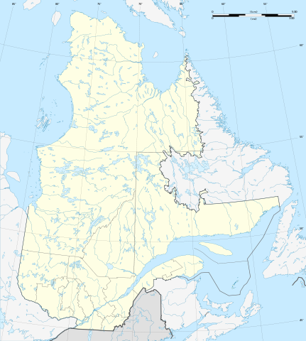
Français : Carte administrative vierge de la province de Québec, Canada, destinée à la géolocalisation.
Scale: 1:7,720,000 (precision: 1,930 m)Equidistant conic A projection, WGS84 datum *Standard parallel: 53° 45' N *Central meridian: 068° 25' 30" W *Origin latitude: 53° 45' N Geographic limits of the map: *Central meridian: 068° 25' 30" W *Top: 63° 27' N (at center) *Bottom: 44° 30' N (at center) |
| Date | (UTC) |
| Source |
This file was derived from: Canada Quebec location map-conic proj.svg |
| Author |
|
Licensing
[edit]
I, the copyright holder of this work, hereby publish it under the following licenses:
This file is licensed under the Creative Commons Attribution-Share Alike 3.0 Unported license.
- You are free:
- to share – to copy, distribute and transmit the work
- to remix – to adapt the work
- Under the following conditions:
- attribution – You must give appropriate credit, provide a link to the license, and indicate if changes were made. You may do so in any reasonable manner, but not in any way that suggests the licensor endorses you or your use.
- share alike – If you remix, transform, or build upon the material, you must distribute your contributions under the same or compatible license as the original.

|
Permission is granted to copy, distribute and/or modify this document under the terms of the GNU Free Documentation License, Version 1.2 or any later version published by the Free Software Foundation; with no Invariant Sections, no Front-Cover Texts, and no Back-Cover Texts. A copy of the license is included in the section entitled GNU Free Documentation License. |
You may select the license of your choice.
Original upload log
[edit]
This image is a derivative work of the following images:
- File:Canada_Quebec_location_map-conic_proj.svg licensed with Cc-by-sa-3.0, GFDL
- 2009-11-13T18:07:27Z Sting 1184x1318 (920781 Bytes) Oups ! (position of one layer)
- 2009-11-13T17:41:40Z Sting 1184x1318 (920772 Bytes) == {{int:filedesc}} == {{Location|53|58|30|N|68|25|30|W|scale:7000000}} {{Information |Description={{en|Blank administrative map of the [[:en:Provinces and territories of Canada|province]] of [[:en:Quebec|Quebec]], [[:en:Can
File history
Click on a date/time to view the file as it appeared at that time.
| Date/Time | Thumbnail | Dimensions | User | Comment | |
|---|---|---|---|---|---|
| current | 08:53, 19 August 2012 | | 1,184 × 1,318 (899 KB) | NordNordWest (talk | contribs) | == {{int:filedesc}} == {{Information |Description={{de|1=Positionskarte von Québec, Kanada}} {{en|Blank administrative map of the province of Quebec, [[:en:Canad... |
You cannot overwrite this file.
File usage on Commons
There are no pages that use this file.
File usage on other wikis
The following other wikis use this file:
- Usage on ar.wikipedia.org
- Usage on de.wikipedia.org
- Centre Bell
- Olympiastadion Montreal
- Québec-Brücke
- Flughafen Montréal-Trudeau
- Wasserkraftwerk Robert-Bourassa
- Aréna Iamgold
- Aréna Jacques Plante
- Centre Air Creebec
- Centre Georges-Vézina
- Centre Henry-Leonard
- Centre Marcel Dionne
- Colisée Desjardins
- Colisée Pepsi
- Colisée Financière Sun Life
- Stade Canac
- Le Nordais
- Forum de Montréal
- Victoria Skating Rink
- Montreal Arena
- Charlevoix (Krater)
- Wikipedia:Kartenwerkstatt/Positionskarten/Nordamerika
- Phare de Pointe-au-Père
- Pont de l’île d’Orléans
- Édifice Marie-Guyart
- Pont Pierre-Laporte
- Phare du Haut-Fond Prince
- Pont de la Concorde
- Pont Jacques-Cartier
- Centre Robert-Guertin
- Stade Saputo
- Centre Gervais Auto
- Flughafen Québec
- 1000 de La Gauchetière
- Tour de la Bourse
- Hafen von Montreal
- 1250 René-Lévesque
- Tour de la Banque Royale
- Maison de Radio-Canada
- Stade Percival-Molson
- Complexe sportif Claude-Robillard
- Édifice Hydro-Québec
- Wasserkraftwerk Beauharnois
- Wasserkraftwerk Bersimis-2
- Wasserkraftwerk Bersimis-1
- Wasserkraftwerk Brisay
- Wasserkraftwerk Laforge-1
- Wasserkraftwerk Laforge-2
- Wasserkraftwerk La Grande-2-A
- Wasserkraftwerk La Grande-1
View more global usage of this file.