File:Canada Newfoundland location map.svg
Jump to navigation
Jump to search

Size of this PNG preview of this SVG file: 524 × 599 pixels. Other resolutions: 210 × 240 pixels | 420 × 480 pixels | 672 × 768 pixels | 896 × 1,024 pixels | 1,791 × 2,048 pixels | 824 × 942 pixels.
Original file (SVG file, nominally 824 × 942 pixels, file size: 236 KB)
Captions
Captions
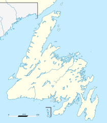
Administrative map of Newfoundland, Canada.
Summary
[edit]| Description |
Français : Carte administrative de Terre-Neuve, Canada.
Čeština: Pee Pee Island se nachází v New Foundlandu Projection équirectangulaire. Image étirée N/S de 160%. Coordonnées des bords de carte :
|
| Date | |
| Source | Canada Newfoundland and Labrador relief location map.jpg |
| Author | NordNordWest (original map), Flappiefh (cropping, scale and graticules). |
| Other versions |
|

Licensing
[edit]
This file is licensed under the Creative Commons Attribution-Share Alike 3.0 Unported license.
- You are free:
- to share – to copy, distribute and transmit the work
- to remix – to adapt the work
- Under the following conditions:
- attribution – You must give appropriate credit, provide a link to the license, and indicate if changes were made. You may do so in any reasonable manner, but not in any way that suggests the licensor endorses you or your use.
- share alike – If you remix, transform, or build upon the material, you must distribute your contributions under the same or compatible license as the original.
File history
Click on a date/time to view the file as it appeared at that time.
| Date/Time | Thumbnail | Dimensions | User | Comment | |
|---|---|---|---|---|---|
| current | 22:13, 27 November 2023 | | 824 × 942 (236 KB) | Tagishsimon (talk | contribs) | Reverted to version as of 21:06, 8 November 2015 (UTC) |
| 00:03, 3 September 2023 |  | 850 × 921 (166 KB) | Palaeozoic99 (talk | contribs) | fixed international border | |
| 21:06, 8 November 2015 |  | 824 × 942 (236 KB) | Flappiefh (talk | contribs) | Removed compass. | |
| 20:58, 8 November 2015 |  | 824 × 942 (244 KB) | Flappiefh (talk | contribs) | User created page with UploadWizard |
You cannot overwrite this file.
File usage on Commons
The following 2 pages use this file:
File usage on other wikis
The following other wikis use this file:
- Usage on ban.wikipedia.org
- Usage on bg.wikipedia.org
- Usage on de.wikipedia.org
- Usage on en.wikipedia.org
- Geography of Saint Pierre and Miquelon
- Paradise, Newfoundland and Labrador
- Holyrood, Newfoundland and Labrador
- Harbour Main-Chapel's Cove-Lakeview
- Avondale, Newfoundland and Labrador
- Conception Harbour
- Colliers, Newfoundland and Labrador
- Whitbourne, Newfoundland and Labrador
- Arnold's Cove
- Come By Chance, Newfoundland and Labrador
- Sunnyside, Newfoundland and Labrador
- Clarenville
- Port Blandford
- Traytown
- Glovertown
- Gambo, Newfoundland and Labrador
- Gander, Newfoundland and Labrador
- Appleton, Newfoundland and Labrador
- Glenwood, Newfoundland and Labrador
- Norris Arm
- Bishop's Falls
- Grand Falls-Windsor
- Badger, Newfoundland and Labrador
- Avalon Peninsula
- Bonavista, Newfoundland and Labrador
- Corner Brook
- Cuper's Cove
- Ferryland
- Belle Isle (Newfoundland and Labrador)
- Upper Island Cove
- Dildo Island
- Stephenville, Newfoundland and Labrador
- Shoal Harbour
- Cape Spear
- Deer Lake, Newfoundland and Labrador
- Channel-Port aux Basques
- Cape Race
- Lawn, Newfoundland and Labrador
- Musgravetown
- Red Bay, Newfoundland and Labrador
- St. Anthony, Newfoundland and Labrador
View more global usage of this file.