File:Camp Mont Shenandoah entrance.jpg
Original file (6,016 × 4,000 pixels, file size: 6.32 MB, MIME type: image/jpeg)
Captions
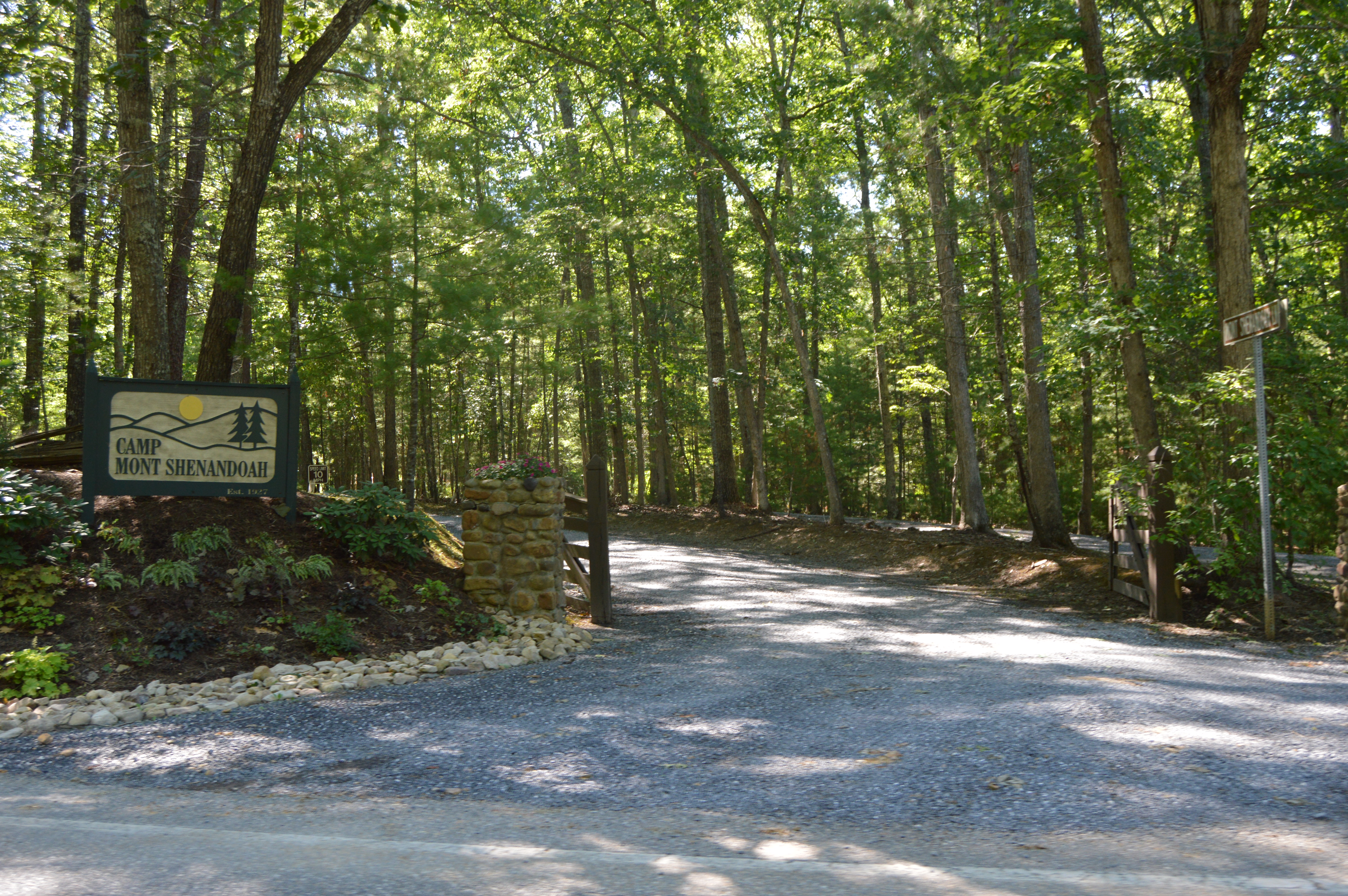
This is an image of a place or building that is listed on the National Register of Historic Places in the United States of America. Its reference number is 15000136. |
Camera location | 37° 59′ 16″ N, 79° 38′ 27″ W | View this and other nearby images on: OpenStreetMap | 37.987778; -79.640833 |
---|
DescriptionCamp Mont Shenandoah entrance.jpg |
English: Main entrance to Camp Mont Shenandoah, located on State Route 42 just southwest of Millboro Springs in Bath County, Virginia, United States. The camp property is listed on the National Register of Historic Places. |
|||
Date | Taken on 30 July 2017 | |||
Source | Own work | |||
Author | Nyttend | |||
Permission (Reusing this file) |
|
File history
Click on a date/time to view the file as it appeared at that time.
Date/Time | Thumbnail | Dimensions | User | Comment | |
---|---|---|---|---|---|
current | 11:17, 22 August 2017 | 6,016 × 4,000 (6.32 MB) | Nyttend (talk | contribs) | {{NRHP|15000136}} {{Location|37|59|16|N|79|38|27|W}} {{Information |Description={{en|Main entrance to {{w|Camp Mont Shenandoah}}, located on {{w|Virginia State Route 42|State Route 42}} just southwest of {{w|Millboro Springs, Virginia|Millboro Springs}... |
You cannot overwrite this file.
File usage on Commons
There are no pages that use this file.
File usage on other wikis
The following other wikis use this file:
- Usage on en.wikipedia.org
- Usage on www.wikidata.org
Metadata
This file contains additional information such as Exif metadata which may have been added by the digital camera, scanner, or software program used to create or digitize it. If the file has been modified from its original state, some details such as the timestamp may not fully reflect those of the original file. The timestamp is only as accurate as the clock in the camera, and it may be completely wrong.
Camera manufacturer | NIKON CORPORATION |
---|---|
Camera model | NIKON D3200 |
Exposure time | 1/125 sec (0.008) |
F-number | f/5.6 |
ISO speed rating | 400 |
Date and time of data generation | 16:50, 30 July 2017 |
Lens focal length | 23 mm |
Orientation | Normal |
Horizontal resolution | 300 dpi |
Vertical resolution | 300 dpi |
Software used | Ver.1.03 |
File change date and time | 16:50, 30 July 2017 |
Y and C positioning | Co-sited |
Exposure Program | Not defined |
Exif version | 2.3 |
Date and time of digitizing | 16:50, 30 July 2017 |
Meaning of each component |
|
Image compression mode | 2 |
APEX exposure bias | 0 |
Maximum land aperture | 3.8 APEX (f/3.73) |
Metering mode | Pattern |
Light source | Unknown |
Flash | Flash did not fire, compulsory flash suppression |
DateTime subseconds | 60 |
DateTimeOriginal subseconds | 60 |
DateTimeDigitized subseconds | 60 |
Supported Flashpix version | 1 |
Color space | sRGB |
Sensing method | One-chip color area sensor |
File source | Digital still camera |
Scene type | A directly photographed image |
Custom image processing | Normal process |
Exposure mode | Auto exposure |
White balance | Auto white balance |
Digital zoom ratio | 1 |
Focal length in 35 mm film | 34 mm |
Scene capture type | Standard |
Scene control | Low gain up |
Contrast | Normal |
Saturation | Normal |
Sharpness | Normal |
Subject distance range | Unknown |
GPS tag version | 2.3.0.0 |
Structured data
Items portrayed in this file
depicts
30 July 2017
37°59'16.001"N, 79°38'26.999"W
image/jpeg
a0cc8806b6d45417d42d400937b6fdfa3ce5a633
6,624,387 byte
4,000 pixel
6,016 pixel
- National Register of Historic Places with known IDs
- National Register of Historic Places missing SDC depicts
- National Register of Historic Places missing SDC location of creation
- Files with coordinates missing SDC location of creation
- United States photographs taken on 2017-07-30
- Self-published work
- PD-self
- Scenery pictures by User:Nyttend
- Pages with maps