File:Camar 2004.jpg
Jump to navigation
Jump to search
Size of this preview: 800 × 600 pixels. Other resolutions: 320 × 240 pixels | 640 × 480 pixels | 1,024 × 768 pixels | 1,280 × 960 pixels | 2,048 × 1,536 pixels.
Original file (2,048 × 1,536 pixels, file size: 763 KB, MIME type: image/jpeg)
Captions
Captions
Add a one-line explanation of what this file represents
Summary
[edit]
| Description |
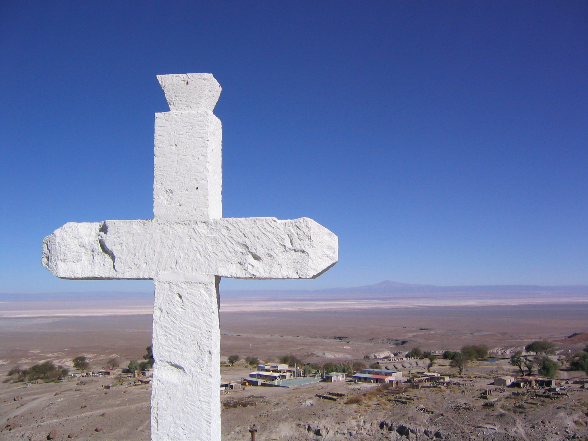
English: Village of Camar, 2.700 m a.s.l. with Salar de Atacama and Cerro Quimal in the background.
Español: Pueblo de Camar, 2.700 m s.n.m. con Salar de Atacama y Cerro Quimal al fondo.
Deutsch: Das Dorf Camar, 2.700 m ü.M. mit dem Salar de Atacama und Cerro Quimal am Horizont. |
| Date | Taken on 3 September 2004, 09:20 |
| Source | Cross |
| Author | Phil Whitehouse from London, United Kingdom |
| Camera location | | View this and other nearby images on: OpenStreetMap |
|---|
Licensing
[edit]
This file is licensed under the Creative Commons Attribution 2.0 Generic license.
- You are free:
- to share – to copy, distribute and transmit the work
- to remix – to adapt the work
- Under the following conditions:
- attribution – You must give appropriate credit, provide a link to the license, and indicate if changes were made. You may do so in any reasonable manner, but not in any way that suggests the licensor endorses you or your use.
| This image was originally posted to Flickr by Phillie Casablanca at https://flickr.com/photos/19451080@N00/2052714986 (archive). It was reviewed on 8 September 2018 by FlickreviewR 2 and was confirmed to be licensed under the terms of the cc-by-2.0. |
| Annotations | This image is annotated: View the annotations at Commons |
File history
Click on a date/time to view the file as it appeared at that time.
| Date/Time | Thumbnail | Dimensions | User | Comment | |
|---|---|---|---|---|---|
| current | 18:44, 8 September 2018 | | 2,048 × 1,536 (763 KB) | WeHaKa (talk | contribs) | {{Information |Description= {{en|Village of Camar, 2.700 m a.s.l. with Salar de Atacama and Cerro Quimal in the background.}} {{es|Pueblo de Camar, 2.700 m s.n.m. con Salar de Atacama y Cerro Quimal al fondo.}} {{de|Das Dorf Camar, 2.700 m ü.M. mit dem Salar de Atacama und Cerro Quimal am Horizont.}} |Source=[https://www.flickr.com/photos/philliecasablanca/2052714986/ Cross] |Date=2004-09-03 09:20 |Author=[https://www.flickr.com/people/19451080@N00 Phil Whitehouse] from London, United Kingdom... |
You cannot overwrite this file.
File usage on Commons
There are no pages that use this file.