File:California map showing Siskiyou County.png
Jump to navigation
Jump to search
No higher resolution available.
California_map_showing_Siskiyou_County.png (200 × 231 pixels, file size: 22 KB, MIME type: image/png)
Captions
Captions
Add a one-line explanation of what this file represents
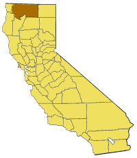
Map of Siskiyou county in California. From en:

|
Permission is granted to copy, distribute and/or modify this document under the terms of the GNU Free Documentation License, Version 1.2 or any later version published by the Free Software Foundation; with no Invariant Sections, no Front-Cover Texts, and no Back-Cover Texts. A copy of the license is included in the section entitled GNU Free Documentation License. |
| This file is licensed under the Creative Commons Attribution-Share Alike 3.0 Unported license. | ||
| ||
| This licensing tag was added to this file as part of the GFDL licensing update. |
File history
Click on a date/time to view the file as it appeared at that time.
| Date/Time | Thumbnail | Dimensions | User | Comment | |
|---|---|---|---|---|---|
| current | 15:28, 14 July 2005 | | 200 × 231 (22 KB) | Pyramide~commonswiki (talk | contribs) | Map of Siskiyou county in California. From en: {{GFDL}} Category:Maps of counties in California |
You cannot overwrite this file.
File usage on Commons
There are no pages that use this file.
File usage on other wikis
The following other wikis use this file:
- Usage on bg.wikipedia.org
- Usage on en.wikipedia.org
- Forks of Salmon, California
- Meiss Lake
- Clear Creek (Sacramento River tributary)
- Klamath National Forest
- Tule Lake
- Trinity Mountains
- Tule Lake National Wildlife Refuge
- Klamath River, California
- Hotlum Glacier
- Bolam Glacier
- Wintun Glacier
- Konwakiton Glacier
- Watkins Glacier
- Mount Eddy
- Salmon Mountain (California)
- Bear Mountain (Siskiyou County, California)
- Cecilville, California
- Lake Siskiyou
- Template:SiskiyouCountyCA-geo-stub
- Kelsey Range
- Kilgore Hills
- Mineral Range
- Panhandle Hills
- Salmon Mountains
- Scott Bar Mountains
- Three Sisters (Siskiyou County)
- Whitehorse Mountains
- Deep Lake (California)
- Somes Bar, California
- Callahan, California
- Horse Creek, California
- Pondosa, California
- Sawyers Bar, California
- Bestville, California
- Hatfield, California–Oregon
- Negro Flat, Siskiyou County, California
- Statue Lake
- Kangaroo Lake (California)
- Black Bear, California
- Alder Creek (Siskiyou County, California)
- Gullion's Bar, California
- Hooperville, California
- Oro Fino, California
- Hambone, California
- Kangaroo Mountain (California)
- Mount Bradley (Siskiyou County, California)
- Balcony Bridge
- Hawkinsville, California
- Picard, California
View more global usage of this file.