File:California Mission San Juan Bautista (cropped).jpg
Original file (2,926 × 1,107 pixels, file size: 815 KB, MIME type: image/jpeg)
Captions
Summary
[edit]DescriptionCalifornia Mission San Juan Bautista (cropped).jpg |
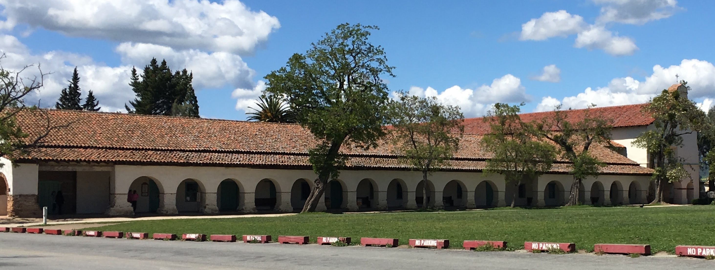
English: A Mission in San Benito County, California founded in 1797 by Farmin Lasuen of the Franciscan order. Named for Saint John the Baptist
|
||||
Date | |||||
Source | Own work | ||||
Author | Carolschmidt333 | ||||
Other versions |
|
Camera location | 36° 50′ 40.99″ N, 121° 32′ 08.59″ W | View this and other nearby images on: OpenStreetMap | 36.844719; -121.535719 |
---|
Licensing
[edit]- You are free:
- to share – to copy, distribute and transmit the work
- to remix – to adapt the work
- Under the following conditions:
- attribution – You must give appropriate credit, provide a link to the license, and indicate if changes were made. You may do so in any reasonable manner, but not in any way that suggests the licensor endorses you or your use.
- share alike – If you remix, transform, or build upon the material, you must distribute your contributions under the same or compatible license as the original.
This image was uploaded as part of Wiki Loves Monuments 2018.
Afrikaans ∙ Alemannisch ∙ العربية ∙ جازايرية ∙ azərbaycanca ∙ Bikol Central ∙ беларуская ∙ беларуская (тарашкевіца) ∙ български ∙ বাংলা ∙ brezhoneg ∙ bosanski ∙ català ∙ čeština ∙ Cymraeg ∙ dansk ∙ Deutsch ∙ Zazaki ∙ Ελληνικά ∙ English ∙ Esperanto ∙ español ∙ eesti ∙ euskara ∙ فارسی ∙ suomi ∙ français ∙ Frysk ∙ Gaeilge ∙ galego ∙ עברית ∙ हिन्दी ∙ hrvatski ∙ magyar ∙ հայերեն ∙ Bahasa Indonesia ∙ Ido ∙ italiano ∙ 日本語 ∙ ქართული ∙ 한국어 ∙ кыргызча ∙ Lëtzebuergesch ∙ latviešu ∙ Malagasy ∙ македонски ∙ മലയാളം ∙ Bahasa Melayu ∙ Malti ∙ norsk bokmål ∙ नेपाली ∙ Nederlands ∙ norsk nynorsk ∙ norsk ∙ polski ∙ português ∙ português do Brasil ∙ română ∙ русский ∙ sicilianu ∙ davvisámegiella ∙ slovenčina ∙ slovenščina ∙ shqip ∙ српски / srpski ∙ svenska ∙ ไทย ∙ Tagalog ∙ Türkçe ∙ українська ∙ اردو ∙ oʻzbekcha / ўзбекча ∙ Yorùbá ∙ 中文 ∙ 中文(中国大陆) ∙ 中文(简体) ∙ 中文(繁體) ∙ 中文(香港) ∙ 中文(臺灣) ∙ +/− |
File history
Click on a date/time to view the file as it appeared at that time.
Date/Time | Thumbnail | Dimensions | User | Comment | |
---|---|---|---|---|---|
current | 02:55, 20 November 2018 | 2,926 × 1,107 (815 KB) | Cristiano Tomás (talk | contribs) | File:California Mission San Juan Bautista.jpg cropped 39 % vertically using CropTool with precise mode. |
You cannot overwrite this file.
File usage on Commons
The following page uses this file:
File usage on other wikis
The following other wikis use this file:
- Usage on uk.wikipedia.org
Metadata
This file contains additional information such as Exif metadata which may have been added by the digital camera, scanner, or software program used to create or digitize it. If the file has been modified from its original state, some details such as the timestamp may not fully reflect those of the original file. The timestamp is only as accurate as the clock in the camera, and it may be completely wrong.
Camera manufacturer | Apple |
---|---|
Camera model | iPhone 6s |
Exposure time | 1/2,481 sec (0.00040306328093511) |
F-number | f/2.2 |
ISO speed rating | 25 |
Date and time of data generation | 14:35, 17 April 2018 |
Lens focal length | 4.15 mm |
Latitude | 36° 50′ 40.99″ N |
Longitude | 121° 32′ 8.59″ W |
Altitude | 68.254 meters above sea level |
Orientation | Normal |
Horizontal resolution | 72 dpi |
Vertical resolution | 72 dpi |
Software used | 11.2.6 |
File change date and time | 14:35, 17 April 2018 |
Y and C positioning | Centered |
Exposure Program | Normal program |
Exif version | 2.21 |
Date and time of digitizing | 14:35, 17 April 2018 |
Meaning of each component |
|
APEX shutter speed | 11.276932826362 |
APEX aperture | 2.2750071245369 |
APEX brightness | 11.244903818547 |
APEX exposure bias | 0 |
Metering mode | Pattern |
Flash | Flash did not fire, auto mode |
DateTimeOriginal subseconds | 299 |
DateTimeDigitized subseconds | 299 |
Supported Flashpix version | 1 |
Color space | sRGB |
Sensing method | One-chip color area sensor |
Scene type | A directly photographed image |
Exposure mode | Auto exposure |
White balance | Auto white balance |
Digital zoom ratio | 1.2076677316294 |
Focal length in 35 mm film | 35 mm |
Scene capture type | Standard |
Unique image ID | a7b502b02c9e02e30000000000000000 |
GPS time (atomic clock) | 21:35 |
Speed unit | Kilometers per hour |
Speed of GPS receiver | 0 |
Reference for direction of image | Magnetic direction |
Direction of image | 337.19987468672 |
Reference for bearing of destination | Magnetic direction |
Bearing of destination | 337.19987468672 |
GPS date | 17 April 2018 |
GPS tag version | 2.2.0.0 |
Structured data
Items portrayed in this file
depicts
17 April 2018
36°50'40.988"N, 121°32'8.588"W
image/jpeg
d50c5553125787c2a3d6972d6baa70962dcffb43
834,054 byte
1,107 pixel
2,926 pixel
- California Historical Landmarks with known IDs
- National Register of Historic Places with known IDs
- Extracted images
- CC-BY-SA-4.0
- Self-published work
- Images from Wiki Loves Monuments 2018
- Images from Wiki Loves Monuments 2018 in the United States
- Images from Wiki Loves Monuments 2018 in California
- Wiki Loves Monuments 2018 in the United States unreviewed
- Uploaded via Campaign:wlm-us
- United States photographs taken on 2018-04-17