File:Calcutta, 1756.png
Jump to navigation
Jump to search
Size of this preview: 800 × 417 pixels. Other resolutions: 320 × 167 pixels | 640 × 334 pixels | 1,024 × 534 pixels | 1,280 × 668 pixels | 3,392 × 1,770 pixels.
Original file (3,392 × 1,770 pixels, file size: 9.31 MB, MIME type: image/png)
Captions
Captions
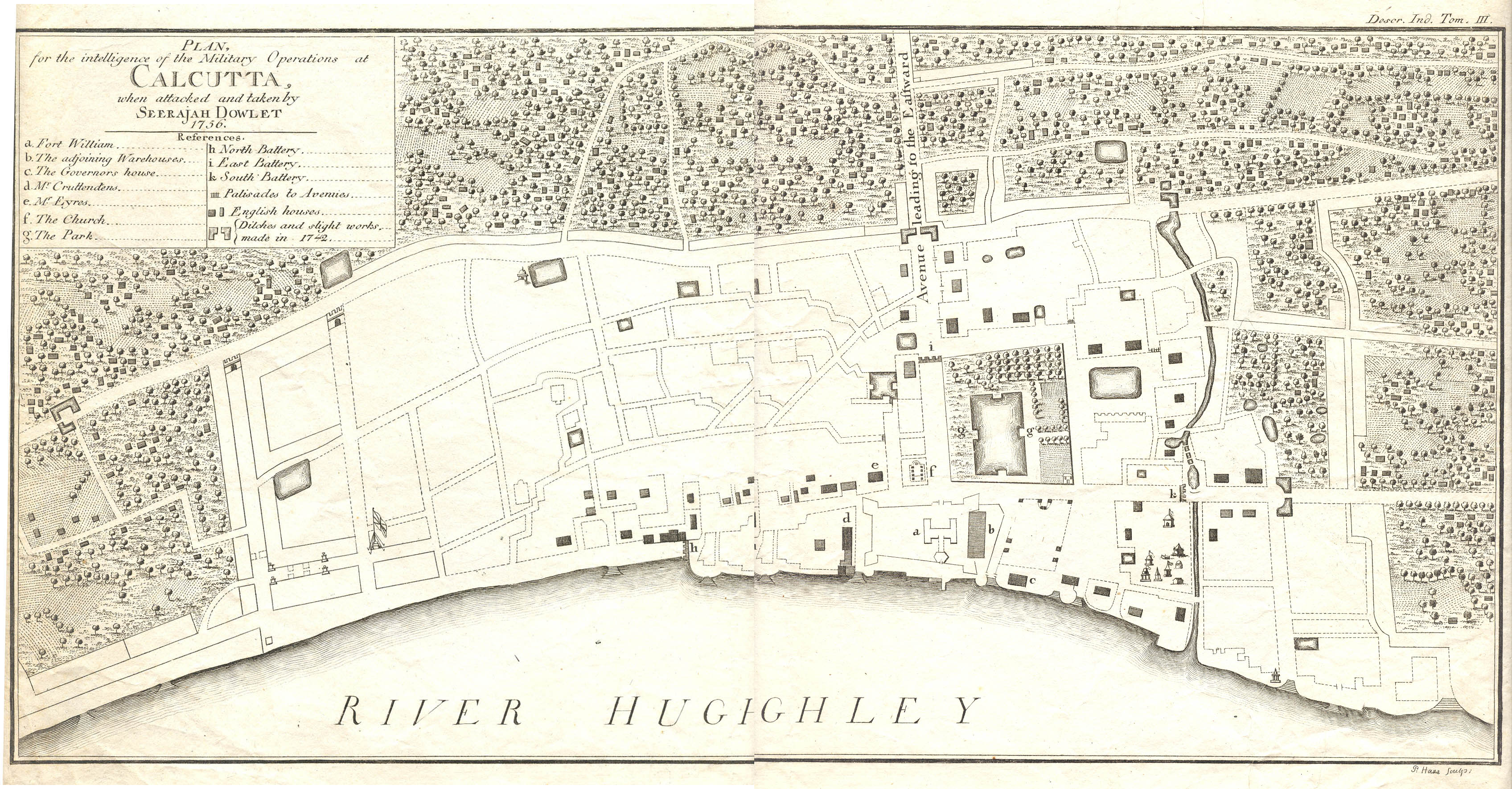
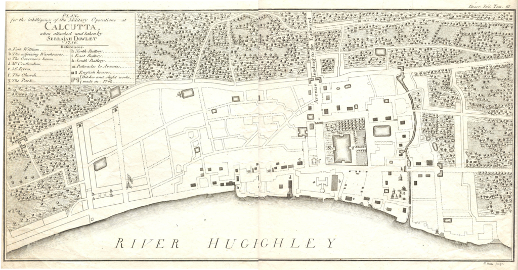
Calcutta, 1756

|
This old map image could be re-created using vector graphics as an SVG file. This has several advantages; see Commons:Media for cleanup for more information. If an SVG form of this image is available, please upload it and afterwards replace this template with
{{vector version available|new image name}}.
It is recommended to name the SVG file “Calcutta, 1756.svg”—then the template Vector version available (or Vva) does not need the new image name parameter. |
Summary
[edit]
| Description |
English: Plan for the intelligence of the military operations at Calcutta, when attacked and taken by Sirajuddaula.
Note: East is at the top of the map. |
| Date | |
| Source | http://www.columbia.edu/itc/mealac/pritchett/00maplinks/colonial/calcuttamaps/call1756/call1756.html |
| Author | John Call and J. Cheevers |
Licensing
[edit]
 |
The author of this work is anonymous and this work was made available to the public more than 50 years ago. According to the Berne convention Art. 7, and the laws of many countries, this work is in the public domain.
Note: This template does not apply to works from countries that extended the Berne Convention or that did not sign it. In particular, this includes the European Union, the United States, India, and Russia. Please use {{PD-anon-70-EU}}, {{PD-US}}, {{PD-India}}, {{PD-Russia-1996}}, etc. in such cases and check Commons:Anonymous works every time, carefully! |
File history
Click on a date/time to view the file as it appeared at that time.
| Date/Time | Thumbnail | Dimensions | User | Comment | |
|---|---|---|---|---|---|
| current | 10:28, 25 October 2020 | | 3,392 × 1,770 (9.31 MB) | Rnrctg (talk | contribs) | Uploaded a work by John Call and J. Cheevers from http://www.columbia.edu/itc/mealac/pritchett/00maplinks/colonial/calcuttamaps/call1756/call1756.html with UploadWizard |
You cannot overwrite this file.
File usage on Commons
There are no pages that use this file.