File:CUX-Langen-Stadt.svg
Jump to navigation
Jump to search

Size of this PNG preview of this SVG file: 416 × 393 pixels. Other resolutions: 254 × 240 pixels | 508 × 480 pixels | 813 × 768 pixels | 1,084 × 1,024 pixels | 2,168 × 2,048 pixels.
Original file (SVG file, nominally 416 × 393 pixels, file size: 67 KB)
Captions
Captions
Add a one-line explanation of what this file represents
Summary
[edit]
| Description |
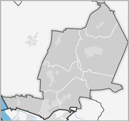
English: Map of Langen (bei Bremerhaven), Germany
Deutsch: Karte der Stadt Langen (bei Bremerhaven), Landkreis Cuxhaven, Deutschland |
| Date | |
| Source |
Own work
|
| Author | Darth Obno altering Creative Commons Files by CWitte and Open Street Map |
Licensing
[edit]
This file is licensed under the Creative Commons Attribution-Share Alike 3.0 Unported license.
- You are free:
- to share – to copy, distribute and transmit the work
- to remix – to adapt the work
- Under the following conditions:
- attribution – You must give appropriate credit, provide a link to the license, and indicate if changes were made. You may do so in any reasonable manner, but not in any way that suggests the licensor endorses you or your use.
- share alike – If you remix, transform, or build upon the material, you must distribute your contributions under the same or compatible license as the original.
File history
Click on a date/time to view the file as it appeared at that time.
| Date/Time | Thumbnail | Dimensions | User | Comment | |
|---|---|---|---|---|---|
| current | 14:19, 17 October 2011 | | 416 × 393 (67 KB) | Darth Obno (talk | contribs) | style |
| 17:15, 2 October 2010 |  | 416 × 393 (58 KB) | Darth Obno (talk | contribs) | == Summary == {{Information |Description={{en|1=Map of Langen (bei Bremerhaven), Germany}} {{de|1=Karte der Stadt Langen (bei Bremerhaven), Landkreis Cuxhaven, Deutschland}} |Source={{own}} *based on the cropped and modified files of: **[[:File:Topomap lo |
You cannot overwrite this file.
File usage on Commons
The following 8 pages use this file: