File:CT-17 map.png
Jump to navigation
Jump to search

Size of this preview: 800 × 585 pixels. Other resolutions: 320 × 234 pixels | 640 × 468 pixels | 1,024 × 749 pixels | 1,280 × 936 pixels | 1,750 × 1,280 pixels.
Original file (1,750 × 1,280 pixels, file size: 59 KB, MIME type: image/png)
Captions
Captions
Add a one-line explanation of what this file represents

|
This file was moved to Wikimedia Commons from en.wikipedia using a bot script. All source information is still present. It requires review. Additionally, there may be errors in any or all of the information fields; information on this file should not be considered reliable and the file should not be used until it has been reviewed and any needed corrections have been made. Once the review has been completed, this template should be removed. For details about this file, see below. Check now! |
Summary
[edit]
| Description |
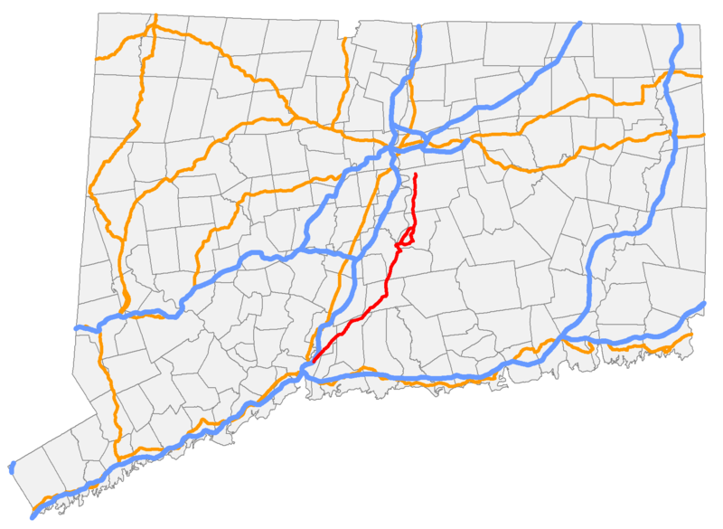
English: Connecticut Route 17. |
| Date | 5 October 2006 (original upload date) |
| Source |
Own work Transferred from en.wikipedia |
| Author | Polaron at en.wikipedia |
Licensing
[edit]
| |
This work has been released into the public domain by its author, Polaron, at the English Wikipedia project. This applies worldwide. In case this is not legally possible: |
Original upload log
[edit]
The original description page was here. All following user names refer to en.wikipedia.
File history
Click on a date/time to view the file as it appeared at that time.
| Date/Time | Thumbnail | Dimensions | User | Comment | |
|---|---|---|---|---|---|
| current | 10:47, 30 December 2011 | | 1,750 × 1,280 (59 KB) | MGA73bot2 (talk | contribs) | {{BotMoveToCommons|en.wikipedia|year={{subst:CURRENTYEAR}}|month={{subst:CURRENTMONTHNAME}}|day={{subst:CURRENTDAY}}}} == {{int:filedesc}} == {{Information |description={{en|1=}} |date={{Date|2006|10|5}} (original upload date) |source={{Own}}<BR />Transf |
You cannot overwrite this file.
File usage on Commons
The following page uses this file:
File usage on other wikis
The following other wikis use this file:
- Usage on www.wikidata.org