File:CSP prospects for the SW USA (3% slopes).jpg
Jump to navigation
Jump to search
Size of this preview: 784 × 600 pixels. Other resolutions: 314 × 240 pixels | 628 × 480 pixels | 1,004 × 768 pixels | 1,280 × 979 pixels | 1,583 × 1,211 pixels.
Original file (1,583 × 1,211 pixels, file size: 1.43 MB, MIME type: image/jpeg)
Captions
Captions
Add a one-line explanation of what this file represents
| Description |
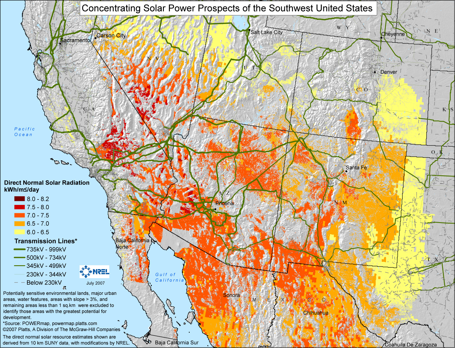
English: Potentially sensitive environmental lands, major urban areas, water features, areas with slope >3%, and remaining areas less than 1 sq.km were excluded to identify those areas with the greatest potential for development. The remaining areas are color-coded for their average isolation, in kW·h/m²/day. |
|||
| Date | ||||
| Source | http://www.nrel.gov/csp/maps.html#south | |||
| Author | NREL | |||
| Permission (Reusing this file) |
|

File history
Click on a date/time to view the file as it appeared at that time.
| Date/Time | Thumbnail | Dimensions | User | Comment | |
|---|---|---|---|---|---|
| current | 22:01, 30 May 2009 | | 1,583 × 1,211 (1.43 MB) | Wwoods (talk | contribs) | {{Information |Description={{en|1=Potentially sensitive environmental lands, major urban areas, water features, areas with slope >3%, and remaining areas less than 1 sq.km were excluded to identify those areas with the greatest potential for development. |
You cannot overwrite this file.
File usage on Commons
There are no pages that use this file.
File usage on other wikis
The following other wikis use this file:
- Usage on ar.wikipedia.org
- Usage on en.wikipedia.org
- Usage on es.wikipedia.org
.jpg&oldid=912792194)