File:CSA Political Map-ca.svg
Jump to navigation
Jump to search

Size of this PNG preview of this SVG file: 800 × 495 pixels. Other resolutions: 320 × 198 pixels | 640 × 396 pixels | 1,024 × 633 pixels | 1,280 × 791 pixels | 2,560 × 1,583 pixels | 959 × 593 pixels.
Original file (SVG file, nominally 959 × 593 pixels, file size: 162 KB)
Captions
Captions
Add a one-line explanation of what this file represents
Summary
[edit]| Description |
[]
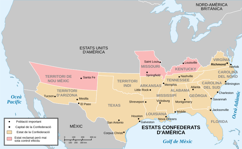
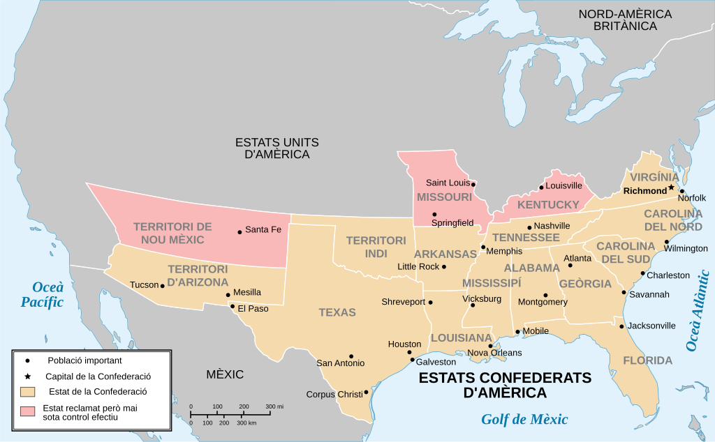
Bosanski: Politička karta Konfederativnih Američkih Država Català: Mapa polític dels Estats Confederats d'Amèrica English: Political map of Confederated States of America Español: Mapa político de los Estados Confederados de América Euskara: Ameriketako Estatu Konfederatuen mapa politikoa Српски (ћирилица): Политичка мапа Конфедеративних Америчких Држава |
||
| Date | (UTC) | ||
| Source |
|
||
| Author |
|
||
| Other versions |
[]
|


Licensing
[edit]

|
Permission is granted to copy, distribute and/or modify this document under the terms of the GNU Free Documentation License, Version 1.2 or any later version published by the Free Software Foundation; with no Invariant Sections, no Front-Cover Texts, and no Back-Cover Texts. A copy of the license is included in the section entitled GNU Free Documentation License. |
Uploaded with derivativeFX
File history
Click on a date/time to view the file as it appeared at that time.
| Date/Time | Thumbnail | Dimensions | User | Comment | |
|---|---|---|---|---|---|
| current | 19:39, 31 March 2011 | | 959 × 593 (162 KB) | SMP (talk | contribs) | {{Information |Description={{ca|Mapa polític dels Estats Confederats d'Amèrica amb el text en català.}} {{en}} Political map of Confederated States of America, text in Catalan. {{es}} Mapa político de los Estados Confederados de América, en catalán. |
You cannot overwrite this file.
File usage on Commons
The following 6 pages use this file:
File usage on other wikis
The following other wikis use this file:
- Usage on ca.wikipedia.org