File:COVID-19 sign.jpg
Original file (2,560 × 1,440 pixels, file size: 1.75 MB, MIME type: image/jpeg)
Captions
Summary
[edit]DescriptionCOVID-19 sign.jpg |
English: 
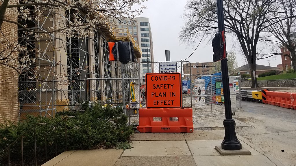
A sign on a construction site for COVID-19 in Downtown State College, Pennsylvania. |
Date | Taken on 19 April 2020, 15:36:44 |
Source | Own work |
Author | Goonsnick |
Permission (Reusing this file) |
I, the copyright holder of this work, hereby publish it under the following license: This file is licensed under the Creative Commons Attribution-Share Alike 4.0 International license.
|
Camera location | 40° 47′ 33.23″ N, 77° 51′ 50.1″ W | View this and other nearby images on: OpenStreetMap | 40.792564; -77.863916 |
---|
File history
Click on a date/time to view the file as it appeared at that time.
Date/Time | Thumbnail | Dimensions | User | Comment | |
---|---|---|---|---|---|
current | 18:30, 3 May 2020 | 2,560 × 1,440 (1.75 MB) | Goonsnick (talk | contribs) | Uploaded own work with UploadWizard |
You cannot overwrite this file.
File usage on Commons
The following 3 pages use this file:
Metadata
This file contains additional information such as Exif metadata which may have been added by the digital camera, scanner, or software program used to create or digitize it. If the file has been modified from its original state, some details such as the timestamp may not fully reflect those of the original file. The timestamp is only as accurate as the clock in the camera, and it may be completely wrong.
Camera manufacturer | samsung |
---|---|
Camera model | SM-G950U |
Exposure time | 1/1,684 sec (0.0005938242280285) |
F-number | f/1.7 |
ISO speed rating | 50 |
Date and time of data generation | 15:36, 19 April 2020 |
Lens focal length | 4.25 mm |
User comments | JKJK0
Œ¯þ¼œÛ±°…?7¤¢´èmÿÿuÝÿÿÉÿÿúŒé©ÿÿ(Ñ#ÿÿÖ@"‘‘‘‘‘`‘‘‘‘‘`’™ ‘@"‘‘‘‘"`’™ ‘@"‘‘P3‘`‘A"‘‘‘€‘Q3‘‘@"‘‘™ ‘`‘‘‘‘‘‘‘‘‘‘a™ ’™ ‘@"‘‘‘‘™ ™ ‘"‘‘‘!"`’™ ‘@"‘‘‘P3‚™ ‚™ "‘‘‘‘`’™ ‘P3‘P3‘P3‚™ ‚™ ‘‘‘‘qª ™ a™ ’™ ‘Q3‘‘‘p‚™ ‚™ p‘‘‘‘€a™ A"A"’™ ’™ ’™ ’™ p™ ™ p‘‘‘‘‘1"’™ ’™ ’™ ’™ ’™ ’™ qª ‚™ ‚™ €@"‘‘‘‘’™ ’™ ’™ ’™ ’™ ’™ ’™ @"``P3@"‘0‘‘’™ ’™ ’™ ’™ ’™ A"A"A"@"@"@"0‘@"@"0’™ ’™ ’™ Q3Q3Q3Q3@"@"P3@"0A"@"‘@"³Qÿ¡ne¨ÿ~—…qûšgû¿gû¿gû¿¸û¿¸û¿( û/fF&tV B 1±P±Pª¡¡½-neneuв8Ŧ|/—FAFA|`qt¡¡3FAFAvÍÿ2ùÿvç“tuÍÿ2ùÿvç“ttVÿÙÿvç£ttVÿÙÿvç£ttVÿÙÿvçãtt{ÿìÿvçÃtt{ÿìÿvçÃtúÐ ð~Ð^FAFAwçyç{çyçzçxçwçŸuçxç|ç‚ç€çxçxçzçvçsçoçpçutçyç}ç‚ç€çzçwçxçsçqçtçqçvçuçzç}ç€ççyçvçxçrçoçsçtçxçuçvç~ç~ç?çtçvçvçrçpçqçuçwçtçvç|ç~ç€çtOyÞuBvçqçoçsçtçxçwç~ç~ç~$isßuâuNuçvçutçwçyç~ç~ç{ç tçÿ®®®®‡¸ 1¡rÒ! __4 .°ÌÒ~ 2”¸ îîîî~i**€U€?úÿÿÿ²à~÷àÒ YÅØ„™ £ ù > ”Øßèâ Ù Ç›bÔåà8Ø€,Bà×EØêx`1¼˜mº „šâ\öËó ,6º×À³ßV ¡3q›H§súÿÿÿÿÒY-üiŽÕÿÿÿiO_2×ÿÿÿ—þÿÿ “?|ÎÿÿÿÕ^y³.U×ÿÿÿ$ÿÿÿÍÿÿÿÍÿÿÿ.$ÿÿÿ³÷…ÿÿÿ#>Õÿÿÿ÷0bI?ùÿÿÿ; ¼ì _syrd] ;c`ssdjagssuniqueidk`3>`ˆ3ssmtfÿÿÿÿÿÿÿÿÿÿÿÿÿÿÿÿÿÿÿÿÿÿÿÿÿÿÿÿÿÿÿÿÿÿÿÿÿÿÿÿÿÿÿÿÿÿÿÿÿÿÿÿÿÿSSCAL PF12QSKC0222401FFC1FC1S12ssoisD84KA02 D84KA02 D84KA02 0 |
Latitude | 40° 47′ 33.23″ N |
Longitude | 77° 51′ 50.1″ W |
Altitude | 315.5 meters above sea level |
Width | 2,560 px |
Height | 1,440 px |
Orientation | Normal |
Horizontal resolution | 72 dpi |
Vertical resolution | 72 dpi |
Software used | G950USQS7DTC1 |
File change date and time | 15:36, 19 April 2020 |
Y and C positioning | Centered |
Exposure Program | Normal program |
Exif version | 2.2 |
Date and time of digitizing | 15:36, 19 April 2020 |
Meaning of each component |
|
APEX shutter speed | 10.717 |
APEX aperture | 1.53 |
APEX brightness | 8.1 |
APEX exposure bias | 0 |
Maximum land aperture | 1.53 APEX (f/1.7) |
Metering mode | Center weighted average |
Light source | Unknown |
Flash | Flash did not fire |
Supported Flashpix version | 1 |
Color space | sRGB |
Sensing method | One-chip color area sensor |
Scene type | A directly photographed image |
Exposure mode | Auto exposure |
White balance | Auto white balance |
Focal length in 35 mm film | 26 mm |
Scene capture type | Standard |
Unique image ID | F12QSJA00SM F12QSKB01SB |
GPS time (atomic clock) | 19:36 |
GPS date | 19 April 2020 |
GPS tag version | 0.0.2.2 |