File:CERA-USGS-labeled.jpg
Jump to navigation
Jump to search

Size of this preview: 766 × 600 pixels. Other resolutions: 307 × 240 pixels | 613 × 480 pixels | 944 × 739 pixels.
Original file (944 × 739 pixels, file size: 335 KB, MIME type: image/jpeg)
Captions
Captions
Add a one-line explanation of what this file represents
Summary
[edit]
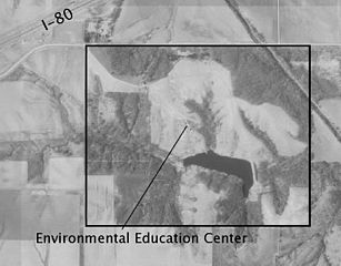
| Description | USGS aerial image of the Conard Environmental Research Area (CERA) in Iowa. Labeled as "Courtesy of U.S. Geological Survey" and "14 km SW of Grinnell, Iowa, United States 4/18/1994". This file is labeled in English and saved as a JPEG. It was edited in Adobe Illustrator. |
| Date | |
| Source | USGS The National Map, via MSR Maps (formerly TerraServer-USA) |
| Author | United States Geological Survey (USGS) |
| Permission (Reusing this file) |
Public domain |
| Other versions |
Licensing
[edit]
This image is in the public domain in the United States because it only contains materials that originally came from the United States Geological Survey, an agency of the United States Department of the Interior. For more information, see the official USGS copyright policy.
|
File history
Click on a date/time to view the file as it appeared at that time.
| Date/Time | Thumbnail | Dimensions | User | Comment | |
|---|---|---|---|---|---|
| current | 13:01, 10 May 2008 | | 944 × 739 (335 KB) | Avram (talk | contribs) | Image from Microsoft TerraServer. Labeled as "Courtesy of U.S. Geological Survey" and "14 km SW of Grinnell, Iowa, United States 4/18/1994" http://terraserver-usa.com/Image.aspx?T=1&S=12&Z=15&X=639&Y=5767&W=3&qs=|kellogg|iowa| This file is labeled in En |
You cannot overwrite this file.
File usage on Commons
The following page uses this file:
File usage on other wikis
The following other wikis use this file:
- Usage on en.wikipedia.org