File:CA 27 I10 I5 NARA 1963 1297.jpg
Jump to navigation
Jump to search

Size of this preview: 725 × 599 pixels. Other resolutions: 290 × 240 pixels | 581 × 480 pixels | 929 × 768 pixels | 1,239 × 1,024 pixels | 1,714 × 1,417 pixels.
Original file (1,714 × 1,417 pixels, file size: 371 KB, MIME type: image/jpeg)
Captions
Captions
Add a one-line explanation of what this file represents
Summary
[edit]
| Description |
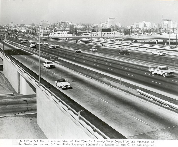
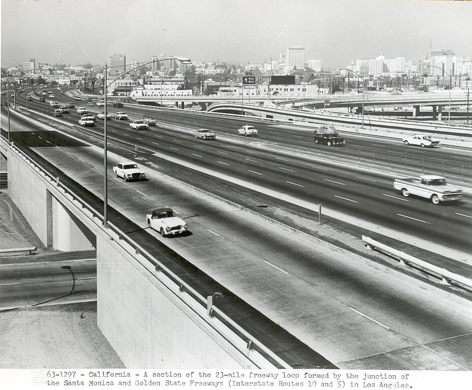
English: A section of the 23-mile freeway loop formed by the junction of the Santa Monica and Golden State Freeways (Interstate Routes 10 and 5) in Los Angeles. |
| Date | |
| Source | https://highways.dot.gov/highway-history/general-highway-history/gallery/interstate-photo-gallery-all-high-resolution-images |
| Author | Federal Highway Adminstration |
Licensing
[edit]
| This image is a work of a United States Department of Transportation employee, taken or made as part of that person's official duties. As a work of the U.S. federal government, the image is in the public domain.
|
File history
Click on a date/time to view the file as it appeared at that time.
| Date/Time | Thumbnail | Dimensions | User | Comment | |
|---|---|---|---|---|---|
| current | 01:40, 22 July 2024 | | 1,714 × 1,417 (371 KB) | TheImaCow (talk | contribs) | Uploaded a work by Federal Highway Adminstration from https://highways.dot.gov/highway-history/general-highway-history/gallery/interstate-photo-gallery-all-high-resolution-images with UploadWizard |
You cannot overwrite this file.
File usage on Commons
There are no pages that use this file.