File:CAN 2012 QF.png
Jump to navigation
Jump to search
No higher resolution available.
CAN_2012_QF.png (596 × 600 pixels, file size: 78 KB, MIME type: image/png)
Captions
Captions
Add a one-line explanation of what this file represents
Summary
[edit]| Description |
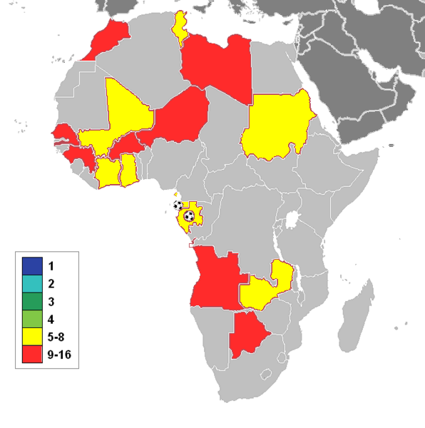
English: Qualified Teams to CAN 2012 Quarter Finals
|
| Date | |
| Source | Own work |
| Author | Pacific kiribati |
| Other versions | File:CAN 2012 QF 2.png - Football African Cup 2012-Qualified countries to semi final |

Licensing
[edit]
I, the copyright holder of this work, hereby publish it under the following license:
This file is licensed under the Creative Commons Attribution-Share Alike 3.0 Unported license.
- You are free:
- to share – to copy, distribute and transmit the work
- to remix – to adapt the work
- Under the following conditions:
- attribution – You must give appropriate credit, provide a link to the license, and indicate if changes were made. You may do so in any reasonable manner, but not in any way that suggests the licensor endorses you or your use.
- share alike – If you remix, transform, or build upon the material, you must distribute your contributions under the same or compatible license as the original.
File history
Click on a date/time to view the file as it appeared at that time.
| Date/Time | Thumbnail | Dimensions | User | Comment | |
|---|---|---|---|---|---|
| current | 22:49, 2 February 2012 | | 596 × 600 (78 KB) | Pacific kiribati (talk | contribs) | Karakazi, go away. You will never win. Take on reality. Leave this map as it should be: neutral. |
| 22:03, 2 February 2012 |  | 596 × 600 (78 KB) | Karakizi (talk | contribs) | Reverted to version as of 19:00, 2 February 2012 | |
| 20:50, 2 February 2012 |  | 596 × 600 (78 KB) | Saibo (talk | contribs) | Reverted to version as of 12:52, 2 February 2012. Last version based on original map. | |
| 19:07, 2 February 2012 |  | 456 × 414 (97 KB) | Pacific kiribati (talk | contribs) | You are spoiling my file with your political one sided and sectarian views. Look at any map of africa and you will discover that western sahara is separate from morocco. It that easy to understand. | |
| 19:00, 2 February 2012 |  | 596 × 600 (78 KB) | Karakizi (talk | contribs) | STOP YOUR GAME | |
| 18:51, 2 February 2012 |  | 456 × 414 (97 KB) | Pacific kiribati (talk | contribs) | Like it or not, do not mix football with politics. Again, if you don't like this, create your own version and leave this one alone. Face reality and forget your political dreams, Zaki. | |
| 16:35, 2 February 2012 |  | 596 × 600 (78 KB) | Karakizi (talk | contribs) | I can not allow you to put a biaised map...stop forcing your point of view, you must accept people's remarks | |
| 16:20, 2 February 2012 |  | 456 × 414 (97 KB) | Pacific kiribati (talk | contribs) | changed colours. Zaki, leave this neutral map alone and create your own version of political kind. Understood? | |
| 16:04, 2 February 2012 |  | 596 × 600 (78 KB) | Pacific kiribati (talk | contribs) | Changed Colours to emphasize qualified nations. Zaki, stop vadalizing the file just for your political views. Again, stop mixing football and politics. Be neutral for one. | |
| 15:52, 2 February 2012 |  | 596 × 600 (78 KB) | Karakizi (talk | contribs) | this is an article of sports not politics, your map is political articles |
You cannot overwrite this file.
File usage on Commons
There are no pages that use this file.