File:Byway to the downs - geograph.org.uk - 1149846.jpg
Jump to navigation
Jump to search
No higher resolution available.
Byway_to_the_downs_-_geograph.org.uk_-_1149846.jpg (640 × 427 pixels, file size: 172 KB, MIME type: image/jpeg)
Captions
Captions
Add a one-line explanation of what this file represents
Summary
[edit]
| Description |
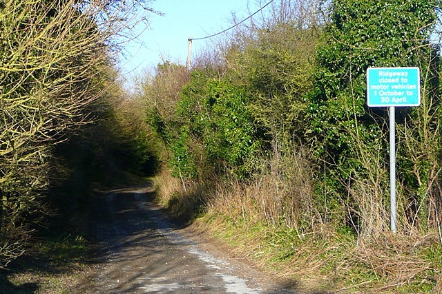
English: Byway to the downs This byway is one of a number that lead up onto the downs and link with the Ridgeway. As part of the management of that route, motor vehicles are prohibited between 1st October and 30th April. West Berkshire Council would have had to make a Traffic Regulation Order to introduce that restriction. |
| Date | |
| Source | From geograph.org.uk |
| Author | Graham Horn |
| Attribution (required by the license) | Graham Horn / Byway to the downs / |
| Camera location | | View this and other nearby images on: OpenStreetMap |
|---|
_heading:22.00&language=en)
| Object location | | View this and other nearby images on: OpenStreetMap |
|---|
_heading:22.00&language=en)
Licensing
[edit]

|
This image was taken from the Geograph project collection. See this photograph's page on the Geograph website for the photographer's contact details. The copyright on this image is owned by Graham Horn and is licensed for reuse under the Creative Commons Attribution-ShareAlike 2.0 license.
|
This file is licensed under the Creative Commons Attribution-Share Alike 2.0 Generic license.
Attribution: Graham Horn
- You are free:
- to share – to copy, distribute and transmit the work
- to remix – to adapt the work
- Under the following conditions:
- attribution – You must give appropriate credit, provide a link to the license, and indicate if changes were made. You may do so in any reasonable manner, but not in any way that suggests the licensor endorses you or your use.
- share alike – If you remix, transform, or build upon the material, you must distribute your contributions under the same or compatible license as the original.
File history
Click on a date/time to view the file as it appeared at that time.
| Date/Time | Thumbnail | Dimensions | User | Comment | |
|---|---|---|---|---|---|
| current | 06:36, 25 February 2011 | | 640 × 427 (172 KB) | GeographBot (talk | contribs) | == {{int:filedesc}} == {{Information |description={{en|1=Byway to the downs This byway is one of a number that lead up onto the downs and link with the Ridgeway. As part of the management of that route, motor vehicles are prohibited between 1st October a |
You cannot overwrite this file.
File usage on Commons
There are no pages that use this file.