File:Bystrá nad Jizerou, čp. 41.jpg
From Wikimedia Commons, the free media repository
Jump to navigation
Jump to search
![File:Bystrá nad Jizerou, čp. 41.jpg](https://upload.wikimedia.org/wikipedia/commons/thumb/7/79/Bystr%C3%A1_nad_Jizerou%2C_%C4%8Dp._41.jpg/800px-Bystr%C3%A1_nad_Jizerou%2C_%C4%8Dp._41.jpg?20180805025505)
Size of this preview: 800 × 551 pixels. Other resolutions: 320 × 220 pixels | 640 × 441 pixels | 1,024 × 705 pixels | 1,280 × 881 pixels | 2,560 × 1,763 pixels | 4,996 × 3,440 pixels.
Original file (4,996 × 3,440 pixels, file size: 2.51 MB, MIME type: image/jpeg)
File information
Structured data
Captions
Captions
Add a one-line explanation of what this file represents
Summary
[edit]DescriptionBystrá nad Jizerou, čp. 41.jpg |
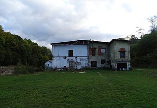
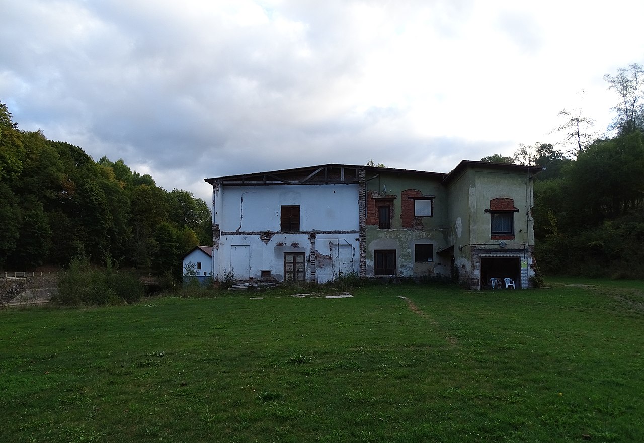
English: Bystrá nad Jizerou, Semily District, Liberec Region, Czechia. Jizera river and a building no. 41.
|
||||
Date | Taken on 27 September 2015 | ||||
Source | Self-photographed | ||||
Author | ŠJů | ||||
Permission (Reusing this file) |
I, the copyright holder of this work, hereby publish it under the following license: ![]() ![]() This file is licensed under the Creative Commons Attribution 4.0 International license. Attribution: ŠJů, Wikimedia Commons
|
File history
Click on a date/time to view the file as it appeared at that time.
Date/Time | Thumbnail | Dimensions | User | Comment | |
---|---|---|---|---|---|
current | 02:55, 5 August 2018 | ![]() | 4,996 × 3,440 (2.51 MB) | ŠJů (talk | contribs) | {{Information |Description= {{cs|1=cs:Benešov u Semil a Bystrá nad Jizerou, okres Semily. Čp. 41.}} {{en|1=en:Benešov u Semil and Bystrá nad Jizerou, Semily District, Liberec Region, Czechia. Jizera river and a building no. 41.}} {{location|50.6075656|15.3919300|region:CZ_heading:065}} |Date= {{Taken on|2015-09-27}} |Source={{self-photographed}... |
You cannot overwrite this file.
File usage on Commons
There are no pages that use this file.
Metadata
This file contains additional information such as Exif metadata which may have been added by the digital camera, scanner, or software program used to create or digitize it. If the file has been modified from its original state, some details such as the timestamp may not fully reflect those of the original file. The timestamp is only as accurate as the clock in the camera, and it may be completely wrong.
Camera manufacturer | SONY |
---|---|
Camera model | DSC-HX400V |
Exposure time | 1/200 sec (0.005) |
F-number | f/3.2 |
ISO speed rating | 80 |
Date and time of data generation | 08:00, 27 September 2015 |
Lens focal length | 4.3 mm |
Latitude | 50° 36′ 27.1″ N |
Longitude | 15° 23′ 31.37″ E |
Altitude | 352 meters above sea level |
Orientation | Normal |
Horizontal resolution | 350 dpi |
Vertical resolution | 350 dpi |
Software used | DSC-HX400V v1.00 |
File change date and time | 08:00, 27 September 2015 |
Y and C positioning | Co-sited |
Exposure Program | Normal program |
Exif version | 2.3 |
Date and time of digitizing | 08:00, 27 September 2015 |
Meaning of each component |
|
Image compression mode | 2 |
APEX brightness | 7.696875 |
APEX exposure bias | 0 |
Maximum land aperture | 2.96875 APEX (f/2.8) |
Metering mode | Pattern |
Light source | Unknown |
Flash | Flash did not fire, compulsory flash suppression |
Supported Flashpix version | 1 |
Color space | sRGB |
File source | Digital still camera |
Scene type | A directly photographed image |
Custom image processing | Normal process |
Exposure mode | Auto exposure |
White balance | Auto white balance |
Digital zoom ratio | 1 |
Scene capture type | Standard |
Contrast | Normal |
Saturation | Normal |
Sharpness | Normal |
GPS time (atomic clock) | 06:00 |
Receiver status | Measurement in progress |
Measurement mode | 3-dimensional measurement |
Measurement precision | Poor (1.57) |
Speed unit | Kilometers per hour |
Speed of GPS receiver | 0.7 |
Reference for direction of movement | True direction |
Direction of movement | 5.15 |
Geodetic survey data used | WGS-84 |
GPS date | 27 September 2015 |
GPS differential correction | 0 |
GPS tag version | 2.3.0.0 |