File:Bydgoszcz Obwod Nadnotecki 1786.jpg
Jump to navigation
Jump to search

Size of this preview: 800 × 589 pixels. Other resolutions: 320 × 236 pixels | 640 × 471 pixels | 1,024 × 754 pixels | 1,289 × 949 pixels.
Original file (1,289 × 949 pixels, file size: 352 KB, MIME type: image/jpeg)
Captions
Captions
Add a one-line explanation of what this file represents
Summary
[edit]
| Description |
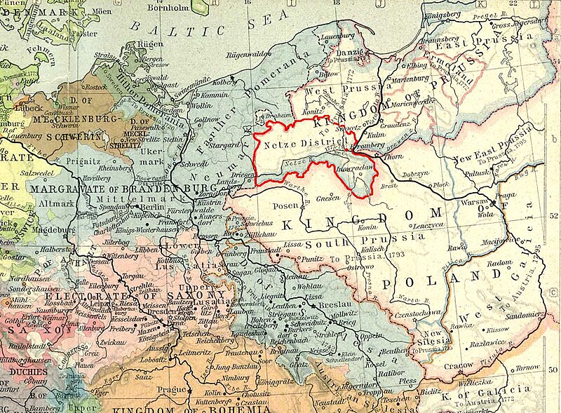
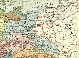
Polski: Obwód Nadnotecki na mapie 1786 r. |
| Date | 10-03-2009 |
| Source | Historical Atlas by William R. Shepherd 1929 r. |
| Author | Pit1233 |
Licensing
[edit]
| I, the copyright holder of this work, release this work into the public domain. This applies worldwide. In some countries this may not be legally possible; if so: I grant anyone the right to use this work for any purpose, without any conditions, unless such conditions are required by law. |
File history
Click on a date/time to view the file as it appeared at that time.
| Date/Time | Thumbnail | Dimensions | User | Comment | |
|---|---|---|---|---|---|
| current | 11:52, 13 March 2009 | | 1,289 × 949 (352 KB) | Pit1233 (talk | contribs) | {{Information |Description={{pl|1=Obwód Nadnotecki na mapie 1786 r.}} |Source=Historical Atlas by William R. Shepherd 1929 r. |Author=Pit1233 |Date=10-03-2009 |Permission= |other_versions= }} <!--{{ImageUpload|full}}--> Category:Bydgoszcz |
You cannot overwrite this file.
File usage on Commons
There are no pages that use this file.
File usage on other wikis
The following other wikis use this file:
- Usage on pl.wikipedia.org