File:Bydgoszcz - Tor regatowy w Brdyujściu widok Trybun - panoramio.jpg
Jump to navigation
Jump to search

Size of this preview: 800 × 451 pixels. Other resolutions: 320 × 180 pixels | 640 × 360 pixels | 1,024 × 577 pixels | 1,280 × 721 pixels | 2,560 × 1,442 pixels | 4,288 × 2,415 pixels.
Original file (4,288 × 2,415 pixels, file size: 3.54 MB, MIME type: image/jpeg)
Captions
Captions
Add a one-line explanation of what this file represents
Summary
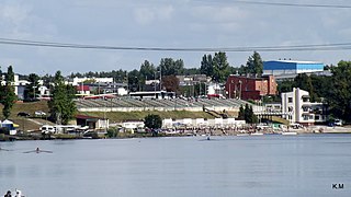
[edit]| Description | Bydgoszcz - Tor regatowy w Brdyujściu widok Trybun | ||
| Date | |||
| Source | https://web.archive.org/web/20161027102554/http://www.panoramio.com/photo/80512785 | ||
| Author | Kazimierz Mendlik | ||
| Permission (Reusing this file) |
This file is licensed under the Creative Commons Attribution-Share Alike 3.0 Unported license. Attribution: Kazimierz Mendlik
|
||
| Tags (from Panoramio photo page) | Bydgoszcz, 2012, Bydgoszcz, Polska |
| Camera location | | View this and other nearby images on: OpenStreetMap |
|---|

File history
Click on a date/time to view the file as it appeared at that time.
| Date/Time | Thumbnail | Dimensions | User | Comment | |
|---|---|---|---|---|---|
| current | 10:18, 12 January 2017 | | 4,288 × 2,415 (3.54 MB) | Panoramio upload bot (talk | contribs) | == {{int:filedesc}} == {{Information |description=Bydgoszcz - Tor regatowy w Brdyujściu widok Trybun |date={{Taken on|2012-09-08}} |source=http://www.panoramio.com/photo/80512785 |author=[http://www.panoramio.com/user/5773884?with_photo_id=80512785 K... |
You cannot overwrite this file.
File usage on Commons
There are no pages that use this file.