File:Bursledon railway station.jpg
Jump to navigation
Jump to search
No higher resolution available.
Bursledon_railway_station.jpg (640 × 480 pixels, file size: 234 KB, MIME type: image/jpeg)
Captions
Captions
Add a one-line explanation of what this file represents
| Description |
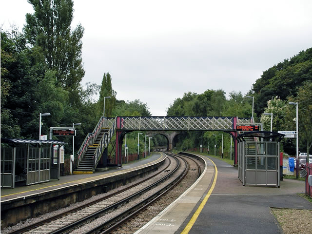
English: Bursledon railway station on the Southampton to Portsmouth line. This station serves the picturesque village of Bursledon. The station is in the far east of the square and here we are looking south. Hidden by the trees to the east (on the left), in the adjacent square SU4909, is the River Hamble. |
| Date | |
| Source | see below |
| Author | see below |
| Object location | | View this and other nearby images on: OpenStreetMap |
|---|
_&language=en)
Licensing
[edit]

|
This image was taken from the Geograph project collection. See this photograph's page on the Geograph website for the photographer's contact details. The copyright on this image is owned by Peter Jordan and is licensed for reuse under the Creative Commons Attribution-ShareAlike 2.0 license.
|
This file is licensed under the Creative Commons Attribution-Share Alike 2.0 Generic license.
Attribution: Peter Jordan
- You are free:
- to share – to copy, distribute and transmit the work
- to remix – to adapt the work
- Under the following conditions:
- attribution – You must give appropriate credit, provide a link to the license, and indicate if changes were made. You may do so in any reasonable manner, but not in any way that suggests the licensor endorses you or your use.
- share alike – If you remix, transform, or build upon the material, you must distribute your contributions under the same or compatible license as the original.
Original upload log
[edit]
The original description page was here. All following user names refer to en.wikipedia.
- 2007-09-29 07:04 Bashereyre 640×480× (83417 bytes) Snap taken by Peter Jordan for “Photograph every grid square” on 30th September 2007and released through “Creative Commons” on 2nd October that year
File history
Click on a date/time to view the file as it appeared at that time.
| Date/Time | Thumbnail | Dimensions | User | Comment | |
|---|---|---|---|---|---|
| current | 10:14, 25 September 2023 | | 640 × 480 (234 KB) | Murgatroyd49 (talk | contribs) | image brightened and colour corrected |
| 23:27, 29 May 2009 |  | 640 × 480 (81 KB) | File Upload Bot (Magnus Manske) (talk | contribs) | {{BotMoveToCommons|en.wikipedia|year={{subst:CURRENTYEAR}}|month={{subst:CURRENTMONTHNAME}}|day={{subst:CURRENTDAY}}}} {{Information |Description={{en|Snap taken by Peter Jordan for “Photograph every grid square” on 30th September 2007and released t |
You cannot overwrite this file.
File usage on Commons
The following 3 pages use this file:
File usage on other wikis
The following other wikis use this file:
- Usage on arz.wikipedia.org
- Usage on en.wikipedia.org
- Usage on nl.wikipedia.org
- Usage on www.wikidata.org