File:Burrupmap.png
Jump to navigation
Jump to search

Size of this preview: 800 × 551 pixels. Other resolutions: 320 × 221 pixels | 640 × 441 pixels | 940 × 648 pixels.
Original file (940 × 648 pixels, file size: 41 KB, MIME type: image/png)
Captions
Captions
Add a one-line explanation of what this file represents
| |
This work has been released into the public domain by its author, Lentisco, at the English Wikipedia project. This applies worldwide. In case this is not legally possible: |
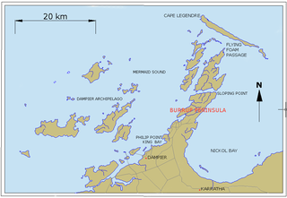
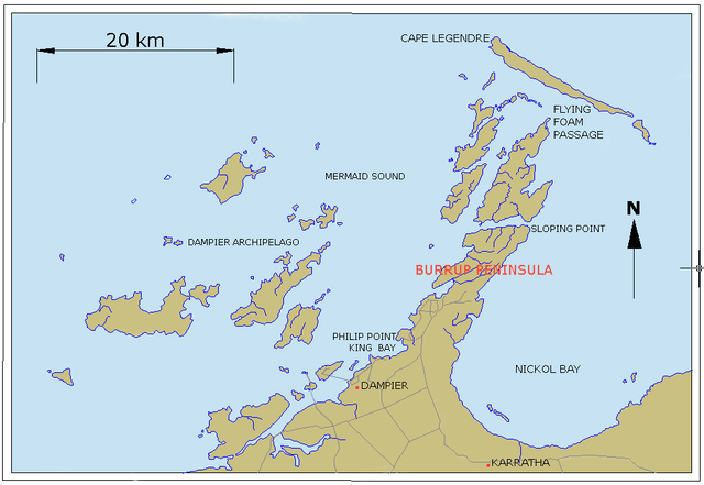
Map of Dampier Archepelago and Burrup Peninsula, Western Australia. Original is/was here.
File history
Click on a date/time to view the file as it appeared at that time.
| Date/Time | Thumbnail | Dimensions | User | Comment | |
|---|---|---|---|---|---|
| current | 11:50, 4 March 2008 | | 940 × 648 (41 KB) | Leptictidium (talk | contribs) | {{PD-user-w|en|English Wikipedia|Lentisco}} Map of Dampier Archepelago and Burrup Peninsula, Western Australia. Original is/was [http://en.wikipedia.org/wiki/Image:Burrupmap.png here]. |
You cannot overwrite this file.
File usage on Commons
There are no pages that use this file.
File usage on other wikis
The following other wikis use this file:
- Usage on ca.wikipedia.org
- Usage on de.wikipedia.org
- Usage on en.wikipedia.org
- Usage on es.wikipedia.org
- Usage on fa.wikipedia.org
- Usage on fr.wikipedia.org
- Usage on hu.wikipedia.org
- Usage on id.wikipedia.org
- Usage on it.wikipedia.org
- Usage on nl.wikipedia.org
- Usage on pl.wikipedia.org
- Usage on pt.wikipedia.org
- Usage on uk.wikipedia.org
- Usage on vi.wikipedia.org