File:Burma Administrative Divisions 2007.jpg
Jump to navigation
Jump to search
Size of this preview: 475 × 599 pixels. Other resolutions: 190 × 240 pixels | 380 × 480 pixels | 609 × 768 pixels | 812 × 1,024 pixels | 1,789 × 2,257 pixels.
Original file (1,789 × 2,257 pixels, file size: 922 KB, MIME type: image/jpeg)
Captions
Captions
Add a one-line explanation of what this file represents
Summary
[edit]
| Description |
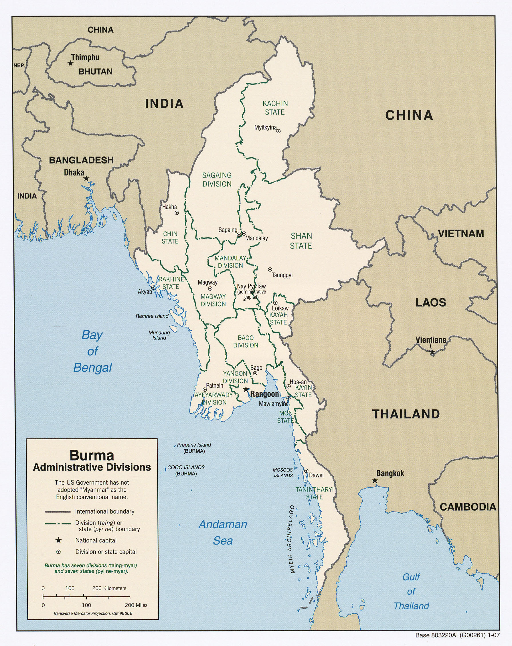
English: Map of Myanmar showing 2007 administrative divisions, Myanmar. |
| Date | |
| Source | http://www.lib.utexas.edu/maps/middle_east_and_asia/txu-oclc-124072555-burma_admin_2007.jpg |
| Author | US Gov |
Licensing
[edit]
This image is in the public domain because it contains materials that originally came from the United States Central Intelligence Agency's World Factbook.
|
 |
Original upload log
[edit]
| This file was imported from Wikivoyage WTS. |
The original description page was here. All following user names refer to wts.wikivoyage-old.
- 2009-12-28 16:04 (WT-shared) Burmesedays[dead link] 1789×2257 (943732 bytes) {{Imagecredit|credit=PD|captureDate=2007|location=Burma|source=http://www.lib.utexas.edu/maps/middle_east_and_asia/txu-oclc-124072555-burma_ (Import from wikitravel.org/shared)
File history
Click on a date/time to view the file as it appeared at that time.
| Date/Time | Thumbnail | Dimensions | User | Comment | |
|---|---|---|---|---|---|
| current | 17:54, 28 December 2012 | | 1,789 × 2,257 (922 KB) | MGA73bot2 (talk | contribs) | {{BotMoveToCommons|wts.oldwikivoyage|year={{subst:CURRENTYEAR}}|month={{subst:CURRENTMONTHNAME}}|day={{subst:CURRENTDAY}}}} == {{int:filedesc}} == {{Information |description=. Map of Myanmar showing 2007 administrative divisions, Myanmar |date=2007 |so... |
You cannot overwrite this file.
File usage on Commons
There are no pages that use this file.