File:Burgstall-Klam-Oberoesterreich-Hauptwall.JPG
Jump to navigation
Jump to search
Size of this preview: 800 × 600 pixels. Other resolutions: 320 × 240 pixels | 640 × 480 pixels | 1,024 × 768 pixels | 1,280 × 960 pixels | 1,600 × 1,200 pixels.
Original file (1,600 × 1,200 pixels, file size: 583 KB, MIME type: image/jpeg)
Captions
Captions
Add a one-line explanation of what this file represents
Summary
[edit]
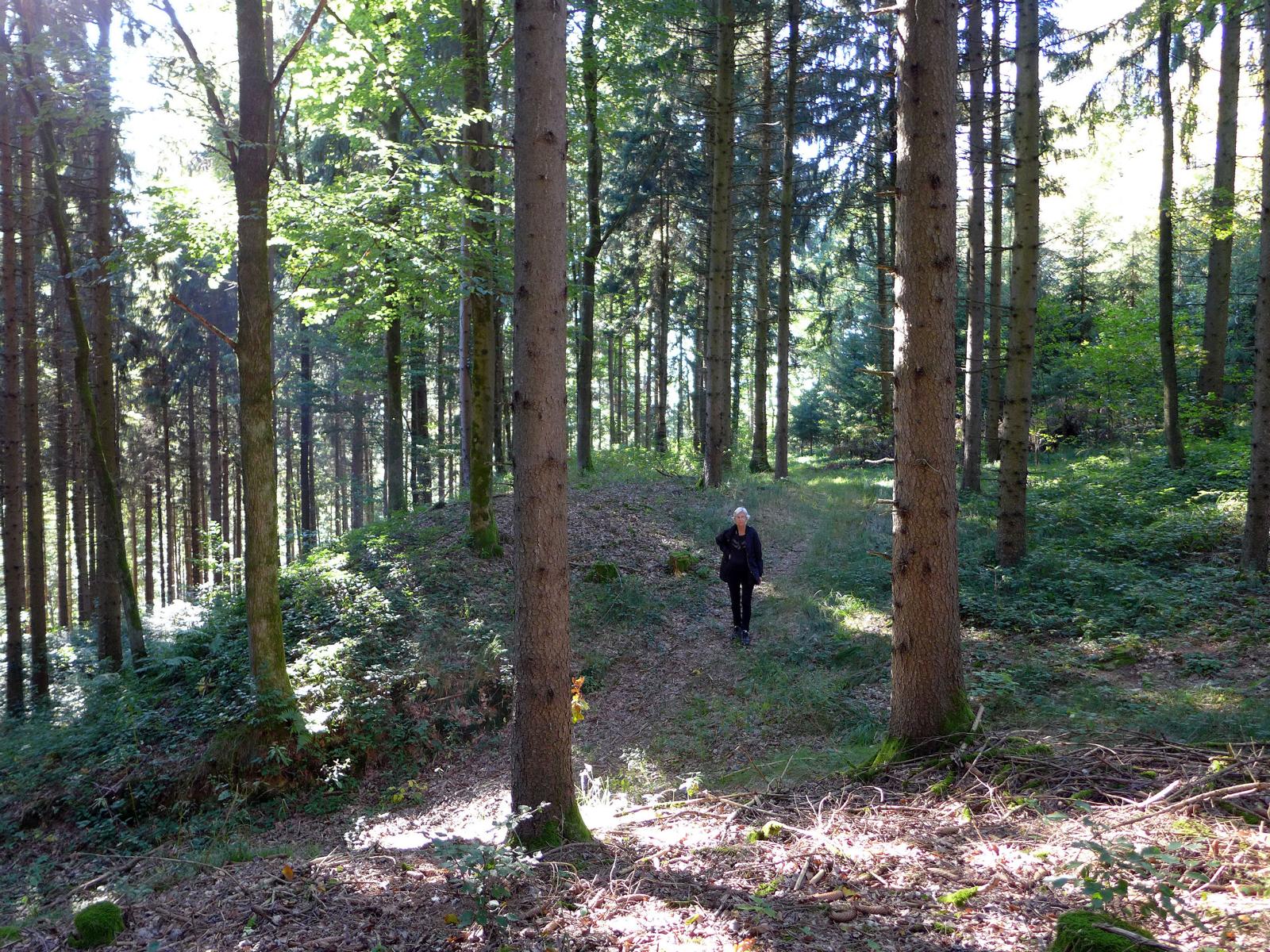
| Description | Der Burgstall ist ein Berg (355 m) mit dem einfachen Namen Burgstall in der Gemeinde Klam in Oberösterreich (Austria). Im Gipfelbereich des Burgstall erhielten sich Erdsubstruktionen bogenförmiger Wallanlagen und zweier Burgställe. Auffällig sichtbar ist eine bogenförmige Wall- und Grabenanlage im Süden und Osten der Bergkuppe. Erhaltene Länge ~260 m. Südlich im Wallverlauf befindet sich ein Einschnitt. Der Wall erscheint dort noch immer 5 m hoch. Der Einschnitt war wenn nicht ein forstwirtschaftlicher Bringungsweg so vielleicht ein alter Eingang in das Wallinnere. Eine Geländevertiefung neben dem Einschnitt mag von der Grabung eines Heimatforschers aus Grein stammen. Bereich >Burgstallberg II< |
| Date | 02-10-2021 |
| Source | Own work |
| Author | TREM-RRRR |
| Permission (Reusing this file) |
eigenes Werk |
Licensing
[edit]
I, the copyright holder of this work, hereby publish it under the following license:
| This file is made available under the Creative Commons CC0 1.0 Universal Public Domain Dedication. | |
| The person who associated a work with this deed has dedicated the work to the public domain by waiving all of their rights to the work worldwide under copyright law, including all related and neighboring rights, to the extent allowed by law. You can copy, modify, distribute and perform the work, even for commercial purposes, all without asking permission.
|
File history
Click on a date/time to view the file as it appeared at that time.
| Date/Time | Thumbnail | Dimensions | User | Comment | |
|---|---|---|---|---|---|
| current | 09:32, 3 October 2021 | | 1,600 × 1,200 (583 KB) | TREM-RRRR (talk | contribs) | {{Information |Description=Der Burgstall ist ein Berg (355 m) mit dem einfachen Namen Burgstall in der Gemeinde Klam in Oberösterreich (Austria). Im Gipfelbereich des Burgstall erhielten sich Erdsubstruktionen bogenförmiger Wallanlagen und zweier Burgställe. Auffällig sichtbar ist eine bogenförmige Wall- und Grabenanlage im Süden und Osten der Bergkuppe. Erhaltene Länge ~260 m. Südlich im Wallverlauf befindet sich ein Einschnitt. Koordinaten {{coordinate|text=DMS |NS=48.218057|EW=14.781002|ty... |
You cannot overwrite this file.
File usage on Commons
The following page uses this file:
File usage on other wikis
The following other wikis use this file:
- Usage on de.wikipedia.org