File:Burgess Shale, Yoho National Park of Canada.jpg
Jump to navigation
Jump to search
Size of this preview: 600 × 600 pixels. Other resolutions: 240 × 240 pixels | 480 × 480 pixels | 768 × 768 pixels | 1,024 × 1,024 pixels | 2,400 × 2,400 pixels.
Original file (2,400 × 2,400 pixels, file size: 3.44 MB, MIME type: image/jpeg)
Captions
Captions
Add a one-line explanation of what this file represents
Summary
[edit]| Description |
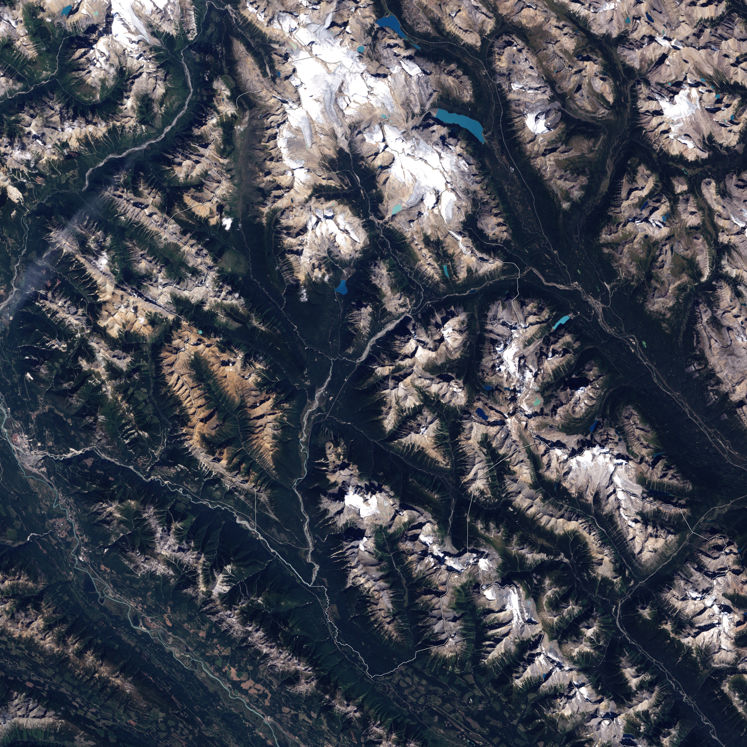
English: This is a true-colour image of the area in British Columbia’s Yoho National Park in which the Burgess Shale Formation is cropping out. This formation is renowned for its abundance of well-preserved Cambrian fossils. The formation is part of the bedrock of a landscape of naked ridges, forested slopes, meandering rivers, and jewel-toned lakes. The Sun is shining from the south-east, and the rugged mountains of the park cast shadows to the north-west. The fossil sites are located approximately in the center of the image on the mountains that are flanking the valley of the Kicking Horse River Image created using Landsat data provided by the United States Geological Survey. Instrument: Landsat 7 - ETM+. |
| Date | |
| Source | NASA Earth Observatory |
| Author | Jesse Allen |
| Other versions |
.jpg)
Licensing
[edit]
| This file is in the public domain in the United States because it was solely created by NASA. NASA copyright policy states that "NASA material is not protected by copyright unless noted". (See Template:PD-USGov, NASA copyright policy page or JPL Image Use Policy.) | ||
 |
Warnings:
|
| Annotations | This image is annotated: View the annotations at Commons |
File history
Click on a date/time to view the file as it appeared at that time.
| Date/Time | Thumbnail | Dimensions | User | Comment | |
|---|---|---|---|---|---|
| current | 09:00, 23 August 2009 | | 2,400 × 2,400 (3.44 MB) | Originalwana (talk | contribs) | {{Information |Description={{en|1=This is a true-colour image of Burgess Shale quarry in British Columbia’s Yoho National Park. The quarry sits in a landscape of naked ridges, forested slopes, meandering rivers, and jewel-toned lakes. The Sun is shining |
You cannot overwrite this file.
File usage on Commons
The following page uses this file:
File usage on other wikis
The following other wikis use this file:
- Usage on ar.wikipedia.org
- Usage on de.wikipedia.org
- Usage on en.wikipedia.org
- Usage on he.wikipedia.org
- Usage on zh.wikipedia.org