File:Bulrushes by Stag Brook, Whitchurch - geograph.org.uk - 1232275.jpg
Jump to navigation
Jump to search

Size of this preview: 409 × 599 pixels. Other resolutions: 164 × 240 pixels | 437 × 640 pixels.
Original file (437 × 640 pixels, file size: 199 KB, MIME type: image/jpeg)
Captions
Captions
Add a one-line explanation of what this file represents
Summary
[edit]
| Description |
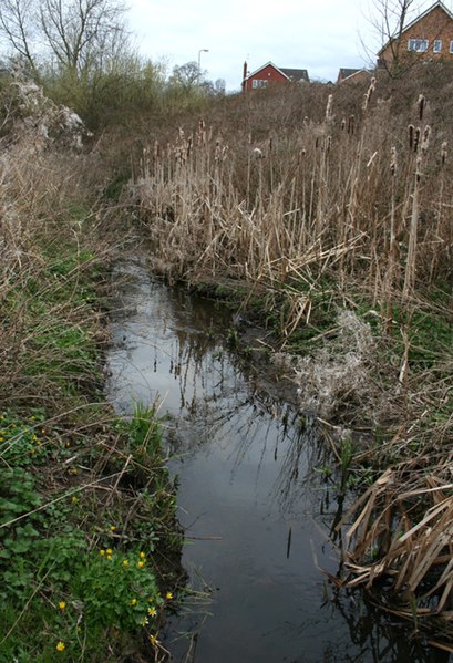
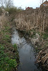
English: Bulrushes by Stag Brook, Whitchurch. A narrow corridor from the centre of Whitchurch westwards that once formed the route of the Whitchurch Arm of the Llangollen Branch of the Shropshire Union has been designed the Whitchurch Waterway Country Park and protected from development. Stag Brook winds its way through the corridor; at this point, immediately to the west of the bridge carrying Greenfields Rise (houses on the right), the brook is lined with bulrushes and clumps of celandine. The area forms a habitat for water voles. See also 1232134 |
| Date | |
| Source | From geograph.org.uk |
| Author | Espresso Addict |
| Attribution (required by the license) | Espresso Addict / Bulrushes by Stag Brook, Whitchurch / |
| Camera location | | View this and other nearby images on: OpenStreetMap |
|---|
_heading:337.00&language=en)
| Object location | | View this and other nearby images on: OpenStreetMap |
|---|
_heading:337.00&language=en)
Licensing
[edit]

|
This image was taken from the Geograph project collection. See this photograph's page on the Geograph website for the photographer's contact details. The copyright on this image is owned by Espresso Addict and is licensed for reuse under the Creative Commons Attribution-ShareAlike 2.0 license.
|
This file is licensed under the Creative Commons Attribution-Share Alike 2.0 Generic license.
Attribution: Espresso Addict
- You are free:
- to share – to copy, distribute and transmit the work
- to remix – to adapt the work
- Under the following conditions:
- attribution – You must give appropriate credit, provide a link to the license, and indicate if changes were made. You may do so in any reasonable manner, but not in any way that suggests the licensor endorses you or your use.
- share alike – If you remix, transform, or build upon the material, you must distribute your contributions under the same or compatible license as the original.
File history
Click on a date/time to view the file as it appeared at that time.
| Date/Time | Thumbnail | Dimensions | User | Comment | |
|---|---|---|---|---|---|
| current | 19:29, 25 December 2011 | | 437 × 640 (199 KB) | Rotatebot (talk | contribs) | Bot: Reset EXIF-specified Orientation of image (EXIF-Orientation set from 6 to 1, rotated 0°) |
| 12:41, 26 February 2011 |  | 640 × 437 (200 KB) | GeographBot (talk | contribs) | == {{int:filedesc}} == {{Information |description={{en|1=Bulrushes by Stag Brook, Whitchurch A narrow corridor from the centre of Whitchurch westwards that once formed the route of the Whitchurch Arm of the Llangollen Branch of the Shropshire Union has be |
You cannot overwrite this file.
File usage on Commons
There are no pages that use this file.
File usage on other wikis
The following other wikis use this file:
- Usage on en.wikipedia.org