File:Bulgaria geographic template.svg
Jump to navigation
Jump to search

Size of this PNG preview of this SVG file: 800 × 505 pixels. Other resolutions: 320 × 202 pixels | 640 × 404 pixels | 1,024 × 646 pixels | 1,280 × 808 pixels | 2,560 × 1,615 pixels | 1,642 × 1,036 pixels.
Original file (SVG file, nominally 1,642 × 1,036 pixels, file size: 3.94 MB)
Captions
Captions
Add a one-line explanation of what this file represents
Summary
[edit]
| Description |
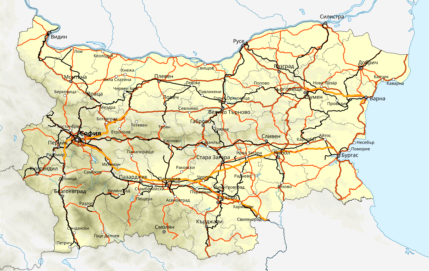
English: Template for geographic and transport map of Bulgaria. May be used for creation of other geographic maps
Geographic limits of the map:
|
| Date | |
| Source |
Own work
|
| Author | Ikonact |
Licensing
[edit]
I, the copyright holder of this work, hereby publish it under the following licenses:
This file is licensed under the Creative Commons Attribution-Share Alike 3.0 Unported license.
- You are free:
- to share – to copy, distribute and transmit the work
- to remix – to adapt the work
- Under the following conditions:
- attribution – You must give appropriate credit, provide a link to the license, and indicate if changes were made. You may do so in any reasonable manner, but not in any way that suggests the licensor endorses you or your use.
- share alike – If you remix, transform, or build upon the material, you must distribute your contributions under the same or compatible license as the original.

|
Permission is granted to copy, distribute and/or modify this document under the terms of the GNU Free Documentation License, Version 1.2 or any later version published by the Free Software Foundation; with no Invariant Sections, no Front-Cover Texts, and no Back-Cover Texts. A copy of the license is included in the section entitled GNU Free Documentation License. |
You may select the license of your choice.
File history
Click on a date/time to view the file as it appeared at that time.
| Date/Time | Thumbnail | Dimensions | User | Comment | |
|---|---|---|---|---|---|
| current | 23:49, 6 September 2012 | | 1,642 × 1,036 (3.94 MB) | Ikonact (talk | contribs) | improved visibility |
| 13:33, 11 March 2012 |  | 1,642 × 1,036 (4.66 MB) | Ikonact (talk | contribs) | opacity fixed | |
| 13:21, 11 March 2012 |  | 1,642 × 1,036 (4.66 MB) | Ikonact (talk | contribs) | town names added, opacity fixed | |
| 06:27, 11 March 2012 |  | 1,642 × 1,036 (4.64 MB) | Ikonact (talk | contribs) | Administrative borders updated, city names added | |
| 22:42, 3 March 2012 |  | 1,642 × 1,036 (4.9 MB) | Ikonact (talk | contribs) | {{Information |Description ={{en|1=Template for geographic and transport map of Bulgaria. May be used for creation of other geographic maps Geographic limits of the map:<br/> *West: 22.1° E<br/> *East: 28.9° E<br/> *North: 44.4° N<br/> *South: 4... |
You cannot overwrite this file.
File usage on Commons
There are no pages that use this file.
File usage on other wikis
The following other wikis use this file:
- Usage on bg.wikipedia.org
- Usage on fr.wikipedia.org