File:Bulgaria Pazardzhik Province relief location map.jpg
Jump to navigation
Jump to search

Size of this preview: 417 × 600 pixels. Other resolutions: 167 × 240 pixels | 500 × 719 pixels.
Original file (500 × 719 pixels, file size: 164 KB, MIME type: image/jpeg)
Captions
Captions
Add a one-line explanation of what this file represents
Summary
[edit]| Description |
|
| Date | |
| Source |
Own work
|
| Author | Ikonact |
| Other versions |
|

Licensing
[edit]
I, the copyright holder of this work, hereby publish it under the following licenses:
This file is licensed under the Creative Commons Attribution-Share Alike 3.0 Unported license.
- You are free:
- to share – to copy, distribute and transmit the work
- to remix – to adapt the work
- Under the following conditions:
- attribution – You must give appropriate credit, provide a link to the license, and indicate if changes were made. You may do so in any reasonable manner, but not in any way that suggests the licensor endorses you or your use.
- share alike – If you remix, transform, or build upon the material, you must distribute your contributions under the same or compatible license as the original.

|
Permission is granted to copy, distribute and/or modify this document under the terms of the GNU Free Documentation License, Version 1.2 or any later version published by the Free Software Foundation; with no Invariant Sections, no Front-Cover Texts, and no Back-Cover Texts. A copy of the license is included in the section entitled GNU Free Documentation License. |
You may select the license of your choice.
File history
Click on a date/time to view the file as it appeared at that time.
| Date/Time | Thumbnail | Dimensions | User | Comment | |
|---|---|---|---|---|---|
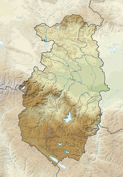
| current | 20:32, 16 June 2013 | | 500 × 719 (164 KB) | Ikonact (talk | contribs) | == {{int:filedesc}} == {{Information |description={{en|1=Relief location map Pazardzhik Province, Bulgaria. Geographic limits of the map:}} {{bg|1=Релефна позиционна карта на [[:bg:О... |
You cannot overwrite this file.
File usage on Commons
The following page uses this file:
File usage on other wikis
The following other wikis use this file:
- Usage on bg.wikipedia.org
- Батак
- Пещера (град)
- Белово
- Брацигово
- Септември (град)
- Стрелча
- Ракитово
- Велинград
- Пазарджик
- Панагюрище
- Ветрен дол
- Ветрен (град)
- Аканджиево
- Габровица
- Голямо Белово
- Дъбравите
- Мененкьово
- Момина клисура (село)
- Сестримо
- Бяга
- Жребичко
- Исперихово
- Козарско
- Равногор
- Биркова
- Бозьова
- Бутрева
- Всемирци
- Враненци
- Грашево
- Горна Биркова
- Горна Дъбева
- Драгиново
- Долна Дъбева
- Кандови
- Кръстава
- Медени поляни
- Пашови
- Рохлева
- Света Петка (област Пазарджик)
- Цветино
- Чолакова
- Алендарова
- Юндола
- Боримечково
- Динката
- Лесичово
- Памидово
- Щърково
- Алеко Константиново
View more global usage of this file.