File:Buchau Staffelsee.jpg
From Wikimedia Commons, the free media repository
Jump to navigation
Jump to search
Size of this preview: 800 × 533 pixels. Other resolutions: 320 × 213 pixels | 640 × 427 pixels | 1,024 × 683 pixels | 1,280 × 853 pixels | 2,560 × 1,707 pixels | 5,616 × 3,744 pixels.
Original file (5,616 × 3,744 pixels, file size: 10.05 MB, MIME type: image/jpeg)
File information
Structured data
Captions
Summary
[edit]DescriptionBuchau Staffelsee.jpg |
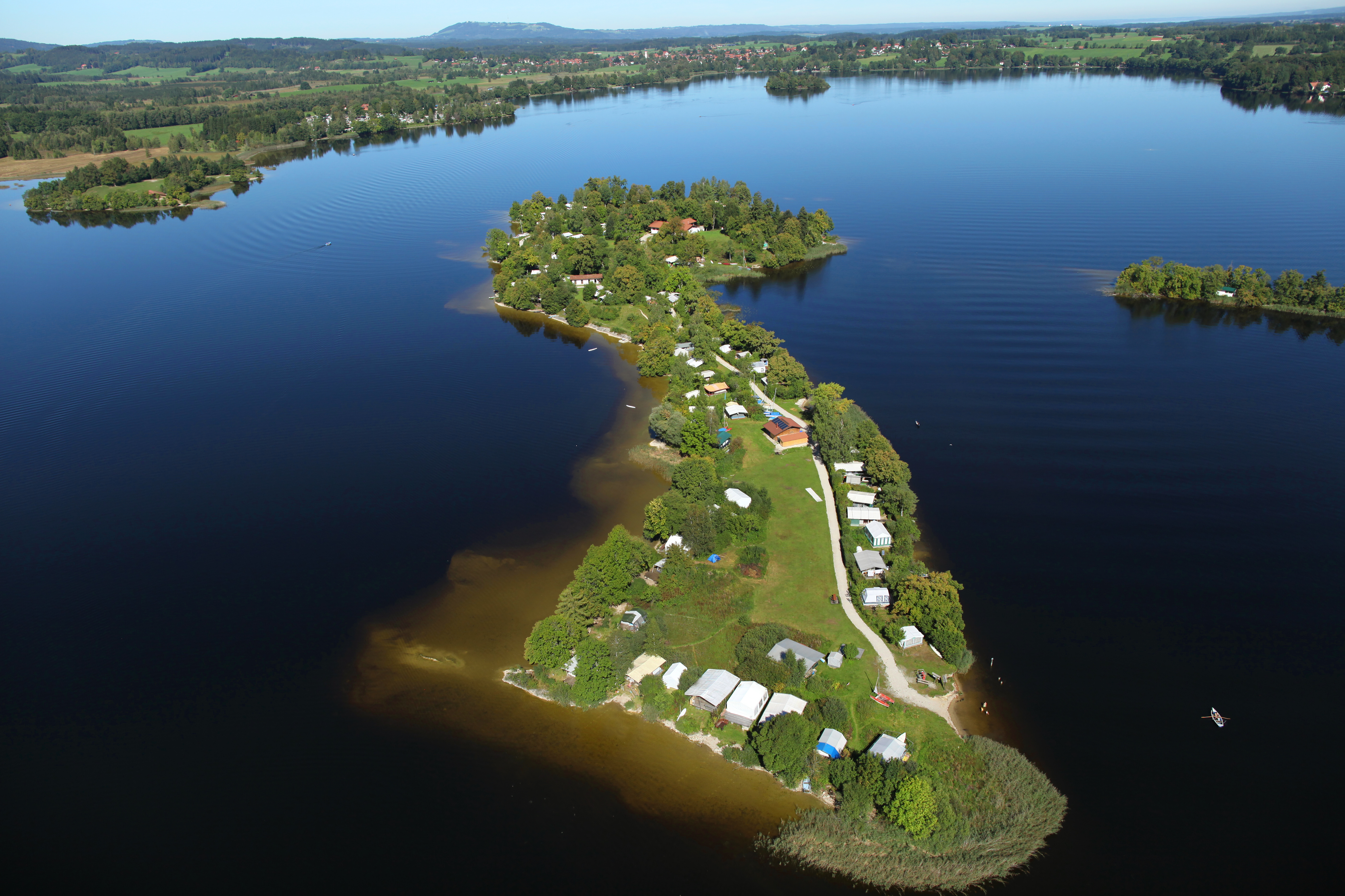
Deutsch: Luftbild der Insel Buchau im Staffelsee, Oberbayern |
||
Date | |||
Source | https://www.panoramio.com/photo/103156897 | ||
Author | burgrain | ||
Permission (Reusing this file) |
|
Camera location | 47° 41′ 21.48″ N, 11° 10′ 32.16″ E | View this and other nearby images on: OpenStreetMap | 47.689300; 11.175600 |
---|
Licensing
[edit]This file is licensed under the Creative Commons Attribution 3.0 Unported license.
- You are free:
- to share – to copy, distribute and transmit the work
- to remix – to adapt the work
- Under the following conditions:
- attribution – You must give appropriate credit, provide a link to the license, and indicate if changes were made. You may do so in any reasonable manner, but not in any way that suggests the licensor endorses you or your use.
Annotations InfoField | This image is annotated: View the annotations at Commons |
4598
997
1011
407
5616
3744
Gradeneiland
3180
274
316
183
5616
3744
Mühlwörth
77
618
1039
344
5616
3744
Lindenbichl (Halbinsel)
1825
183
1615
140
5616
3744
Uffing am Staffelsee
File history
Click on a date/time to view the file as it appeared at that time.
Date/Time | Thumbnail | Dimensions | User | Comment | |
---|---|---|---|---|---|
current | 10:28, 10 August 2015 | 5,616 × 3,744 (10.05 MB) | Thgoiter (talk | contribs) | == {{int:filedesc}} == {{Information |Description ={{de|1=Luftbild der Insel Buchau im Staffelsee, Oberbayern}} |Source =http://www.panoramio.com/photo/103156897 |Author =[http://www.panoramio.com/user/2357550 burgrain] |Date... |
You cannot overwrite this file.
File usage on Commons
The following 3 pages use this file:
File usage on other wikis
The following other wikis use this file:
- Usage on ceb.wikipedia.org
- Usage on de.wikipedia.org
- Usage on pl.wikivoyage.org
- Usage on www.wikidata.org
Metadata
This file contains additional information such as Exif metadata which may have been added by the digital camera, scanner, or software program used to create or digitize it. If the file has been modified from its original state, some details such as the timestamp may not fully reflect those of the original file. The timestamp is only as accurate as the clock in the camera, and it may be completely wrong.
Camera manufacturer | Canon |
---|---|
Camera model | Canon EOS 5D Mark II |
Exposure time | 1/3,200 sec (0.0003125) |
F-number | f/4.5 |
ISO speed rating | 320 |
Date and time of data generation | 11:21, 10 September 2011 |
Lens focal length | 24 mm |
Latitude | 47° 41′ 21.41″ N |
Longitude | 11° 10′ 32.07″ E |
Altitude | 756 meters above sea level |
Orientation | Normal |
Horizontal resolution | 72 dpi |
Vertical resolution | 72 dpi |
Software used | Adobe Photoshop CS4 Windows |
File change date and time | 11:29, 1 August 2012 |
Y and C positioning | Co-sited |
Exposure Program | Aperture priority |
Exif version | 2.21 |
Date and time of digitizing | 11:21, 10 September 2011 |
Meaning of each component |
|
APEX shutter speed | 11.625 |
APEX aperture | 4.375 |
APEX exposure bias | −0.66666666666667 |
Metering mode | Pattern |
Flash | Flash did not fire, compulsory flash suppression |
DateTime subseconds | 66 |
DateTimeOriginal subseconds | 66 |
DateTimeDigitized subseconds | 66 |
Supported Flashpix version | 1 |
Color space | sRGB |
Focal plane X resolution | 3,849.2117888965 |
Focal plane Y resolution | 3,908.1419624217 |
Focal plane resolution unit | inches |
Custom image processing | Normal process |
Exposure mode | Auto exposure |
White balance | Manual white balance |
Scene capture type | Standard |
GPS time (atomic clock) | 09:21 |
Speed unit | Kilometers per hour |
Speed of GPS receiver | 103 |
Geodetic survey data used | WGS-84 |
GPS date | 10 September 2011 |
GPS tag version | 0.0.2.2 |
Supported Flashpix version | 1 |
Image width | 5,616 px |
Image height | 3,744 px |
Compression scheme | JPEG (old) |
Date metadata was last modified | 13:29, 1 August 2012 |
Unique ID of original document | xmp.did:472B36F2B9DBE1119EEF913D8D5BCC18 |