File:Brussels from air 1.jpg
Jump to navigation
Jump to search

Size of this preview: 800 × 533 pixels. Other resolutions: 320 × 213 pixels | 640 × 427 pixels | 1,024 × 683 pixels | 1,280 × 853 pixels | 2,400 × 1,600 pixels.
Original file (2,400 × 1,600 pixels, file size: 2.4 MB, MIME type: image/jpeg)
Captions
Captions
Add a one-line explanation of what this file represents
Summary
[edit]
| Description |
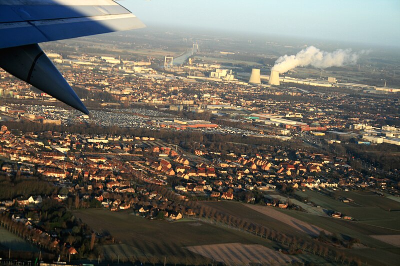
English: Aerial photograph of the Vilvoorde power plant and the Brussels-Scheldt canal near Grimbergen, Belgium
|
| Date | |
| Source | Own work |
| Author | Karelj |
| Camera location | | View this and other nearby images on: OpenStreetMap |
|---|
Licensing
[edit]
| I, the copyright holder of this work, release this work into the public domain. This applies worldwide. In some countries this may not be legally possible; if so: I grant anyone the right to use this work for any purpose, without any conditions, unless such conditions are required by law. |
File history
Click on a date/time to view the file as it appeared at that time.
| Date/Time | Thumbnail | Dimensions | User | Comment | |
|---|---|---|---|---|---|
| current | 22:28, 22 January 2011 | | 2,400 × 1,600 (2.4 MB) | Karelj (talk | contribs) | {{Information |Description ={{en|1=Airview on Brussels city, Belgium}} {{cs|1=Letecký pohled na část [:cs:Brusel|Bruselu], hlavního města Belgie}} |Source ={{own}} |Author =Karelj |Da |
You cannot overwrite this file.
File usage on Commons
There are no pages that use this file.