File:Bruck an der Mur - Neues Ottokar-Kernstock-Haus.JPG
Jump to navigation
Jump to search

Size of this preview: 800 × 540 pixels. Other resolutions: 320 × 216 pixels | 640 × 432 pixels | 1,024 × 691 pixels | 1,280 × 864 pixels | 2,560 × 1,728 pixels | 4,382 × 2,957 pixels.
Original file (4,382 × 2,957 pixels, file size: 9.87 MB, MIME type: image/jpeg)
Captions
Captions
Add a one-line explanation of what this file represents
Summary
[edit]| Description |
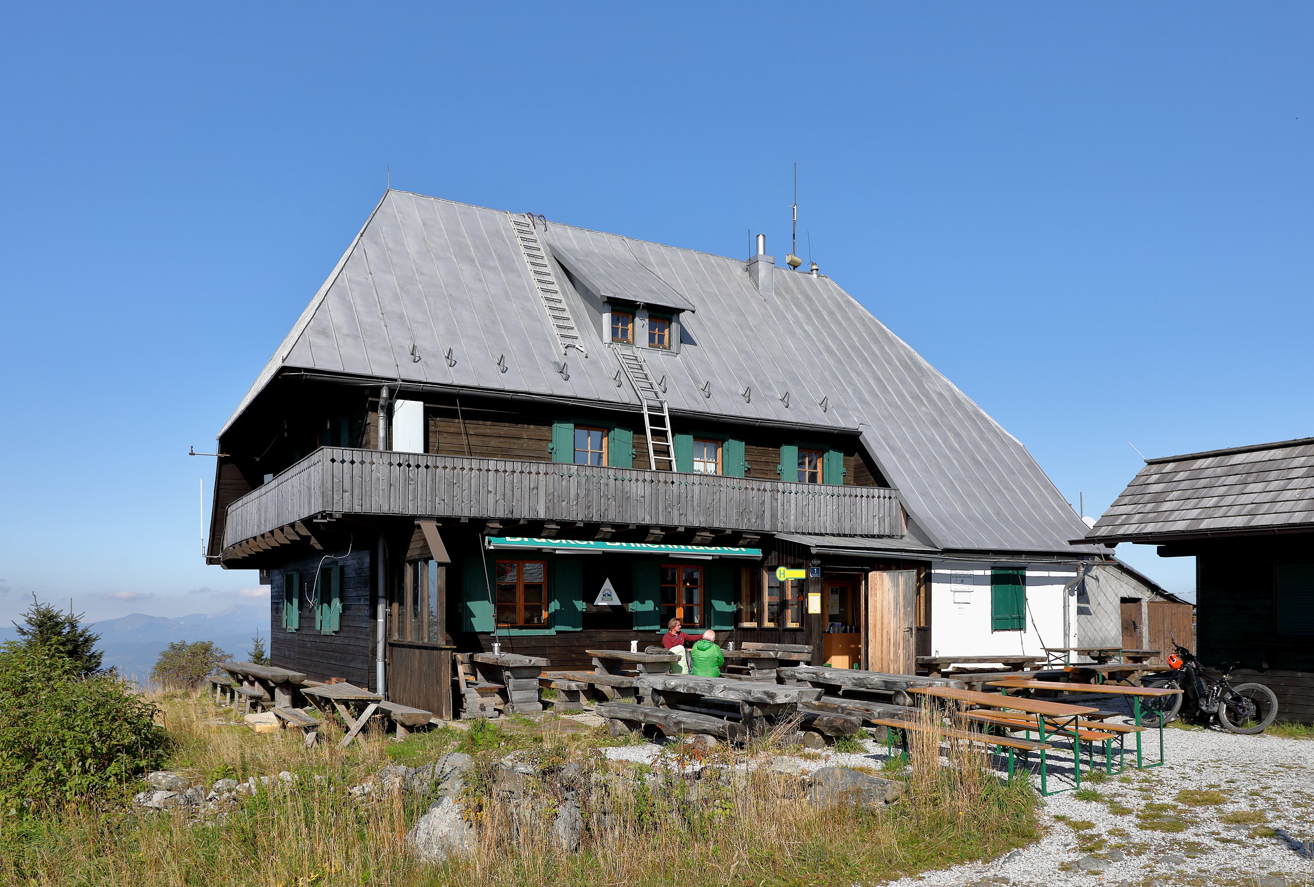
Deutsch: Südwestansicht des Neuen Ottokar-Kernstock-Hauses. Das Schutzhaus auf 1619 m Höhe befindet sich rund 100 m nördlich des Gipfels vom Rennfeld und auf dem Gemeindegebiet der steiermärkischen Stadtgemeinde Bruck an der Mur. Die nach dem Ottokar Kernstock (1848–1928) benannte Schutzhütte wurde ursprünglich am 30. Juli 1911 feierlich eingeweiht. Als architektonisches Vorbild für das Schutzhaus fungierte der Kluppeneggerhof, das Geburtshaus des Heimatdichters Peter Rosegger am Alpl bei Krieglach. Am 29. Juli 1949 brannte sie ab und wurde vom Alpenverein, Sektion Bruck a.d. Mur, wieder aufgebaut und am 5. August 1951 mit dem Zusatz „neues“ feierlich eröffnet. |
| Date | |
| Source | Own work |
| Author | C.Stadler/Bwag |
| Permission (Reusing this file) |
Deutsch: Hallo, du darfst mein Foto kostenlos nutzen, aber nenne mich bitte als Fotograf, beispielsweise „Foto: C.Stadler/Bwag“ oder © C.Stadler/Bwag; CC-BY-SA-4.0. Auf mehr Angaben bestehe ich nicht - im Gegensatz zu manch anderen, die die Vorgaben der unten angeführten Lizenzierung auf Punkt und Beistrich einfordern. English: Feel free to use my photos, but please mention me as the author like © C.Stadler/Bwag or © C.Stadler/Bwag; CC-BY-SA-4.0 (that's good enough) and if you want send me a message: bwag@gmx.net. |
| Other versions |
|
.JPG)
| Object location | | View this and other nearby images on: OpenStreetMap |
|---|
| Camera location | | View this and other nearby images on: OpenStreetMap |
|---|
Licensing
[edit]
I, the copyright holder of this work, hereby publish it under the following license:
This file is licensed under the Creative Commons Attribution-Share Alike 4.0 International license.
- You are free:
- to share – to copy, distribute and transmit the work
- to remix – to adapt the work
- Under the following conditions:
- attribution – You must give appropriate credit, provide a link to the license, and indicate if changes were made. You may do so in any reasonable manner, but not in any way that suggests the licensor endorses you or your use.
- share alike – If you remix, transform, or build upon the material, you must distribute your contributions under the same or compatible license as the original.

|
Diese Datei wurde im Rahmen von WikiDaheim 2019 in Österreich erstellt und hochgeladen. Sie wurde dem allgemeinen Themenbereich zugeordnet. |
File history
Click on a date/time to view the file as it appeared at that time.
| Date/Time | Thumbnail | Dimensions | User | Comment | |
|---|---|---|---|---|---|
| current | 21:09, 1 October 2019 | | 4,382 × 2,957 (9.87 MB) | Bwag (talk | contribs) | {{Information |Description= {{de|1= Südwestansicht des Neuen Ottokar-Kernstock-Hauses. Das Schutzhaus auf 1619 m Höhe befindet sich rund 100 m nördlich des Gipfels vom Rennfeld und auf dem Gemeindegebiet der steiermärkischen Stadtgemeinde Bruck an der Mur.<br/>Die nach dem Ottokar Kernstock (1848–1928) benannte Schutzhütte wurde ursprünglich am 30. Juli 1911 feierlich eingeweiht. Als architekto... |
You cannot overwrite this file.
File usage on Commons
The following 2 pages use this file:
File usage on other wikis
The following other wikis use this file:
- Usage on de.wikipedia.org
- Liste der Hütten des Österreichischen Alpenvereins
- Wikipedia:WikiProjekt Österreich/WD/Bruck-Mürzzuschlag
- Wikipedia:Projekt WikiAlpenforum (WAF)/Artikelwunsch Alpenverein/Schutzhütten nach Gebirgszug
- Wikipedia:Projekt WikiAlpenforum (WAF)/Artikelwunsch Alpenverein/Schutzhütten nach Verwaltungseinheit
- Usage on www.wikidata.org