File:Brough Aerodrome - geograph.org.uk - 446766.jpg
Jump to navigation
Jump to search
Size of this preview: 441 × 599 pixels. Other resolutions: 176 × 240 pixels | 471 × 640 pixels.
Original file (471 × 640 pixels, file size: 86 KB, MIME type: image/jpeg)
Captions
Captions
Add a one-line explanation of what this file represents
Summary
[edit]
| Description |
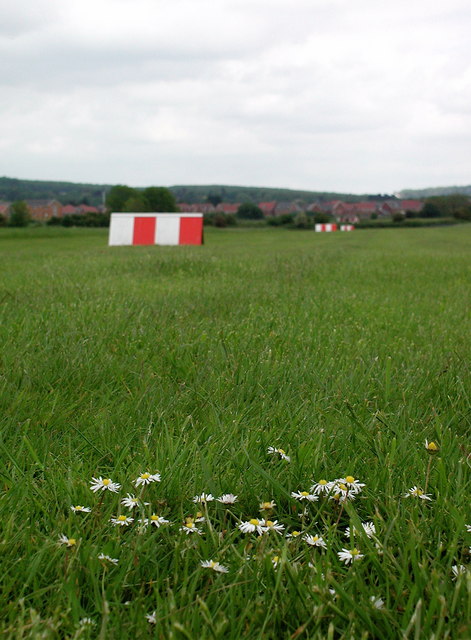
English: Brough Aerodrome Brough Aerodrome was first used during world war one by the Blackburn Aeroplane and Motor Company as a test site for seaplanes. The company became Blackburn and General Aircraft Limited in 1949, part of Hawker Siddeley Aviation in the 1960s, then part of British Aerospace and later BAE Systems. Aircraft built at Brough are now tested elsewhere and the aerodrome closed in the 1990s. |
| Date | |
| Source | From geograph.org.uk |
| Author | Paul Glazzard |
| Permission (Reusing this file) |
Creative Commons Attribution Share-alike license 2.0 |
| Attribution (required by the license) | Paul Glazzard / Brough Aerodrome / |
| Camera location | | View this and other nearby images on: OpenStreetMap |
|---|
_heading:45.00&language=en)
| Object location | | View this and other nearby images on: OpenStreetMap |
|---|
_heading:45.00&language=en)
Licensing
[edit]

|
This image was taken from the Geograph project collection. See this photograph's page on the Geograph website for the photographer's contact details. The copyright on this image is owned by Paul Glazzard and is licensed for reuse under the Creative Commons Attribution-ShareAlike 2.0 license.
|
This file is licensed under the Creative Commons Attribution-Share Alike 2.0 Generic license.
Attribution: Paul Glazzard
- You are free:
- to share – to copy, distribute and transmit the work
- to remix – to adapt the work
- Under the following conditions:
- attribution – You must give appropriate credit, provide a link to the license, and indicate if changes were made. You may do so in any reasonable manner, but not in any way that suggests the licensor endorses you or your use.
- share alike – If you remix, transform, or build upon the material, you must distribute your contributions under the same or compatible license as the original.
File history
Click on a date/time to view the file as it appeared at that time.
| Date/Time | Thumbnail | Dimensions | User | Comment | |
|---|---|---|---|---|---|
| current | 10:47, 4 February 2011 | | 471 × 640 (86 KB) | GeographBot (talk | contribs) | == {{int:filedesc}} == {{Information |description={{en|1=Brough Aerodrome Brough Aerodrome was first used during world war one by the Blackburn Aeroplane and Motor Company as a test site for seaplanes. The company became Blackburn and General Aircraft Lim |
You cannot overwrite this file.
File usage on Commons
There are no pages that use this file.