File:Britse zweefvliegtuigen op de Reijerscamp bij autosnelweg Arnhem-Utrecht.jpg
Jump to navigation
Jump to search

Size of this preview: 744 × 599 pixels. Other resolutions: 298 × 240 pixels | 596 × 480 pixels | 954 × 768 pixels | 1,271 × 1,024 pixels | 2,543 × 2,048 pixels | 3,084 × 2,484 pixels.
Original file (3,084 × 2,484 pixels, file size: 620 KB, MIME type: image/jpeg)
Captions
Captions
Add a one-line explanation of what this file represents
Summary
[edit]
| Description |
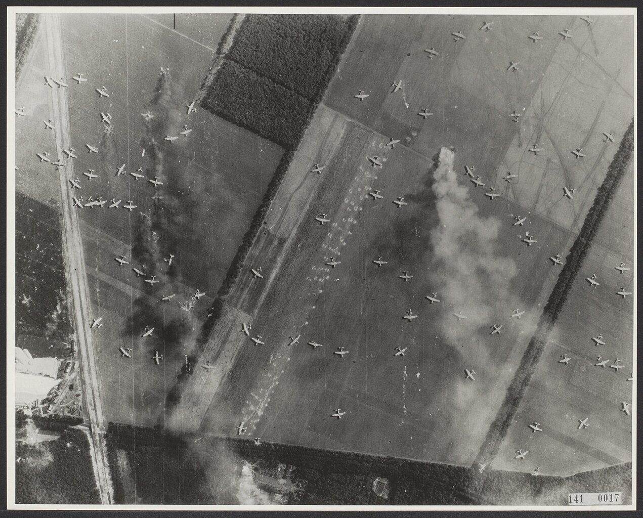
Nederlands: Luchtopname [Operatie Market Garden = Slag om Arnhem]. Britse zweefvliegtuigen op de Reijerscamp tussen Ede en Wolfheze. Enkele toestellen staan in brand na Duitse beschietingen. De witte streep is het tracé van de autosnelweg Arnhem-Utrecht |
| Date | |
| Source | http://proxy.handle.net/10648/ae308034-d0b4-102d-bcf8-003048976d84 |
| Author | RAF |
| Camera location | | View this and other nearby images on: OpenStreetMap |
|---|
Licensing
[edit]
This work created by the United Kingdom Government is in the public domain.
This is because it is one of the following:
HMSO has declared that the expiry of Crown Copyrights applies worldwide (ref: HMSO Email Reply)
|
 |
This is an image from the Nationaal Archief, the Dutch National Archives, donated in the context of a partnership program. This tag does not indicate the copyright status of the attached work. A normal copyright tag is still required. See Commons:Licensing.
|
| Annotations | This image is annotated: View the annotations at Commons |
File history
Click on a date/time to view the file as it appeared at that time.
| Date/Time | Thumbnail | Dimensions | User | Comment | |
|---|---|---|---|---|---|
| current | 01:48, 4 March 2016 | | 3,084 × 2,484 (620 KB) | Hannolans (talk | contribs) | User created page with UploadWizard |
You cannot overwrite this file.
File usage on Commons
The following 3 pages use this file:
File usage on other wikis
The following other wikis use this file:
- Usage on nl.wikipedia.org
- Usage on www.wikidata.org