File:Bristol map 1946.jpg
Jump to navigation
Jump to search
Size of this preview: 645 × 599 pixels. Other resolutions: 258 × 240 pixels | 517 × 480 pixels | 827 × 768 pixels | 1,102 × 1,024 pixels | 2,204 × 2,048 pixels | 4,960 × 4,608 pixels.
Original file (4,960 × 4,608 pixels, file size: 3.75 MB, MIME type: image/jpeg)
Captions
Captions
Add a one-line explanation of what this file represents
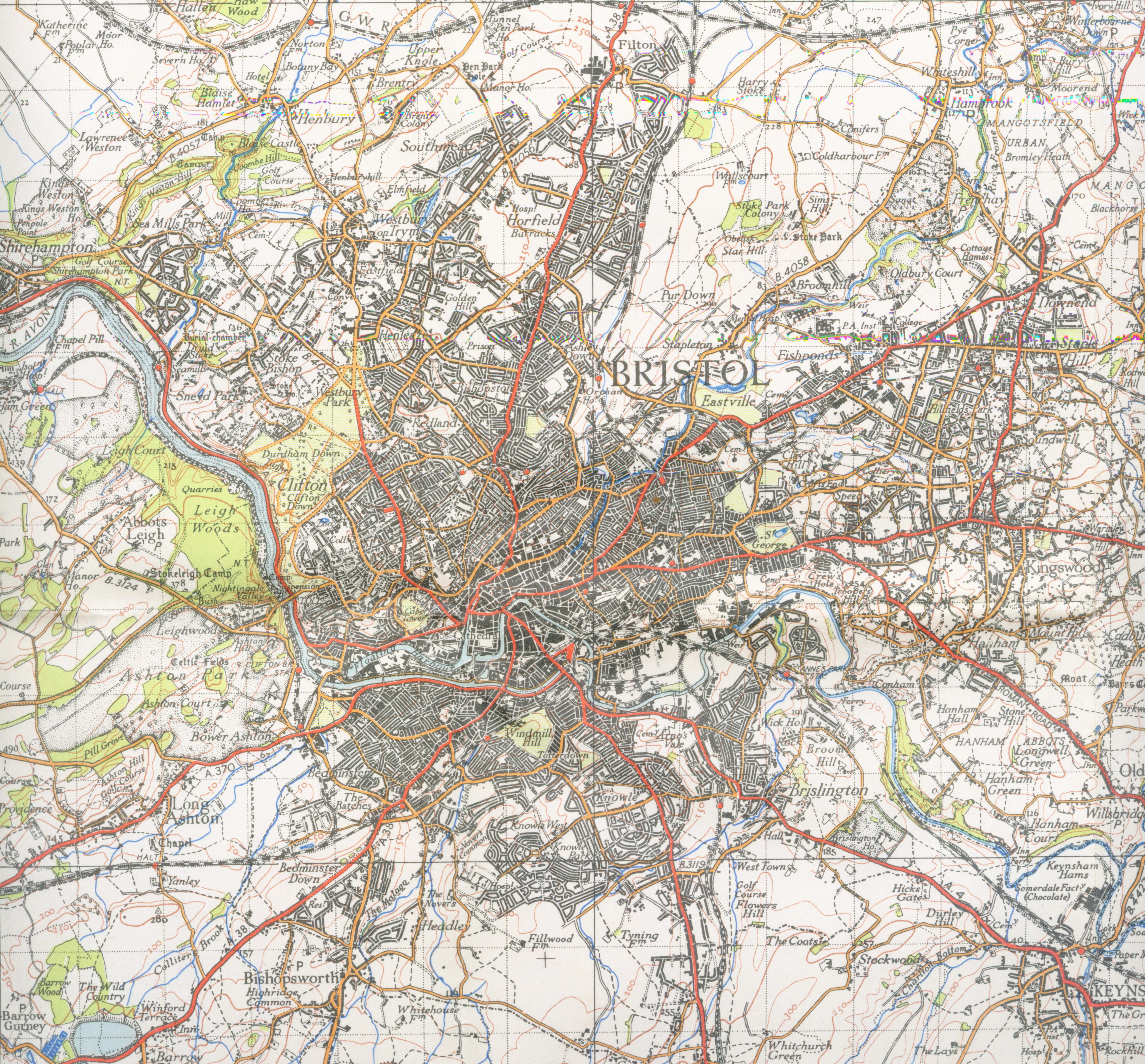
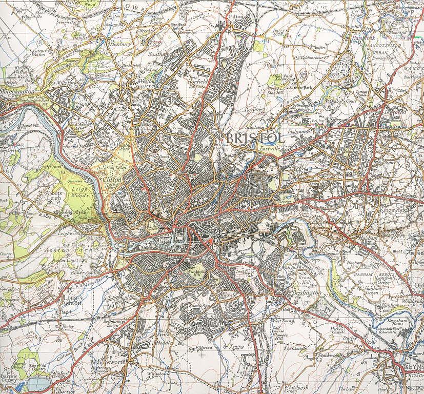
| Description | Map of Bristol from 1946. Scale 1 inch to the mile 600DPI Sheet 156 | ||||
| Date | |||||
| Source | OS | ||||
| Author | OS | ||||
| Permission (Reusing this file) |
|

| Camera location | | View this and other nearby images on: OpenStreetMap |
|---|
File history
Click on a date/time to view the file as it appeared at that time.
| Date/Time | Thumbnail | Dimensions | User | Comment | |
|---|---|---|---|---|---|
| current | 22:10, 1 December 2007 | | 4,960 × 4,608 (3.75 MB) | Geni (talk | contribs) | trying again |
| 17:20, 16 September 2007 |  | 4,352 × 4,800 (3.39 MB) | Geni (talk | contribs) | {{Information |Description=Map of Bristol from 1946. Scale 1 inch to the mile 600DPI Sheet 156 |Source=OS |Date=1946 |Author=OS |Permission=none needed |other_versions= }} {{oldOS}} Category:Maps of cities in the United Kingdom Category:Bristol |
You cannot overwrite this file.
File usage on Commons
There are no pages that use this file.
File usage on other wikis
The following other wikis use this file:
- Usage on azb.wikipedia.org
- Usage on en.wikipedia.org
- Usage on he.wikipedia.org
- Usage on kn.wikipedia.org