File:Bright Angel Point Trail.jpg
Jump to navigation
Jump to search

Size of this preview: 799 × 163 pixels. Other resolutions: 320 × 65 pixels | 640 × 131 pixels | 1,024 × 209 pixels | 1,280 × 261 pixels | 2,560 × 522 pixels | 14,953 × 3,051 pixels.
Original file (14,953 × 3,051 pixels, file size: 10.18 MB, MIME type: image/jpeg)
Captions
Captions
Add a one-line explanation of what this file represents
Summary
[edit]
| Camera location | | View this and other nearby images on: OpenStreetMap |
|---|
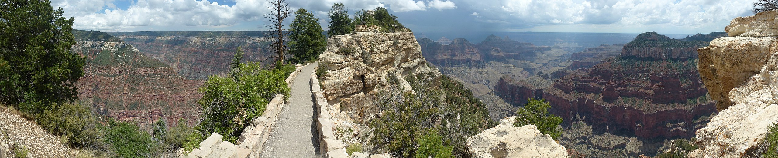
| Description |
English: View heading towards Bright Angel Point on the Bright Angel Point Trail near the Grand Canyon Lodge. |
| Date | |
| Source | Own work |
| Author | Little Mountain 5 |
Licensing
[edit]
I, the copyright holder of this work, hereby publish it under the following license:
This file is licensed under the Creative Commons Attribution-Share Alike 3.0 Unported license.
- You are free:
- to share – to copy, distribute and transmit the work
- to remix – to adapt the work
- Under the following conditions:
- attribution – You must give appropriate credit, provide a link to the license, and indicate if changes were made. You may do so in any reasonable manner, but not in any way that suggests the licensor endorses you or your use.
- share alike – If you remix, transform, or build upon the material, you must distribute your contributions under the same or compatible license as the original.
| Annotations | This image is annotated: View the annotations at Commons |
File history
Click on a date/time to view the file as it appeared at that time.
| Date/Time | Thumbnail | Dimensions | User | Comment | |
|---|---|---|---|---|---|
| current | 00:03, 18 August 2012 | 14,953 × 3,051 (10.18 MB) | Little Mountain 5 (talk | contribs) |
You cannot overwrite this file.
File usage on Commons
There are no pages that use this file.
File usage on other wikis
The following other wikis use this file:
- Usage on en.wikipedia.org