File:Bridge over mill race - geograph.org.uk - 829608.jpg
Jump to navigation
Jump to search
No higher resolution available.
Bridge_over_mill_race_-_geograph.org.uk_-_829608.jpg (640 × 480 pixels, file size: 193 KB, MIME type: image/jpeg)
Captions
Captions
Add a one-line explanation of what this file represents
Summary
[edit]
| Description |
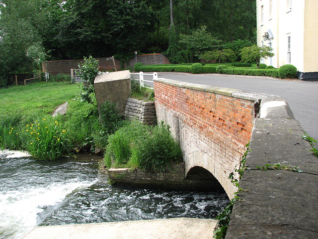
English: Bridge over mill race. View along Mill Road by the former Buxton water mill. A public footpath starts at the western end of the bridge and leads along the bank of the River Bure, through a sheep pasture, and onwards to Little Hautbois further southeast. See > 829560 for a view from this footpath towards its start.
The large concrete block resting beside the bridge (seen in mid-distance, at left) is one of four WWII anti tank blocks that formed part of a demolition belt which ran along the River Bure, reaching from Great Yarmouth to Ingworth. Defence of Britain database ref: S0001272. |
| Date | |
| Source | From geograph.org.uk |
| Author | Evelyn Simak |
| Attribution (required by the license) | Evelyn Simak / Bridge over mill race / |
| Camera location | | View this and other nearby images on: OpenStreetMap |
|---|
_heading:315.00&language=en)
| Object location | | View this and other nearby images on: OpenStreetMap |
|---|
_heading:315.00&language=en)
Licensing
[edit]

|
This image was taken from the Geograph project collection. See this photograph's page on the Geograph website for the photographer's contact details. The copyright on this image is owned by Evelyn Simak and is licensed for reuse under the Creative Commons Attribution-ShareAlike 2.0 license.
|
This file is licensed under the Creative Commons Attribution-Share Alike 2.0 Generic license.
Attribution: Evelyn Simak
- You are free:
- to share – to copy, distribute and transmit the work
- to remix – to adapt the work
- Under the following conditions:
- attribution – You must give appropriate credit, provide a link to the license, and indicate if changes were made. You may do so in any reasonable manner, but not in any way that suggests the licensor endorses you or your use.
- share alike – If you remix, transform, or build upon the material, you must distribute your contributions under the same or compatible license as the original.
File history
Click on a date/time to view the file as it appeared at that time.
| Date/Time | Thumbnail | Dimensions | User | Comment | |
|---|---|---|---|---|---|
| current | 15:06, 20 February 2011 | | 640 × 480 (193 KB) | GeographBot (talk | contribs) | == {{int:filedesc}} == {{Information |description={{en|1=Bridge over mill race View along Mill Road by the former Buxton water mill. A public footpath starts at the western end of the bridge and leads along the bank of the River Bure, through a sheep past |
You cannot overwrite this file.
File usage on Commons
There are no pages that use this file.