File:Bridge in Westover Borough.jpg
Jump to navigation
Jump to search

Size of this preview: 723 × 600 pixels. Other resolutions: 289 × 240 pixels | 579 × 480 pixels | 764 × 634 pixels.
Original file (764 × 634 pixels, file size: 46 KB, MIME type: image/jpeg)
Captions
Captions
Add a one-line explanation of what this file represents
|
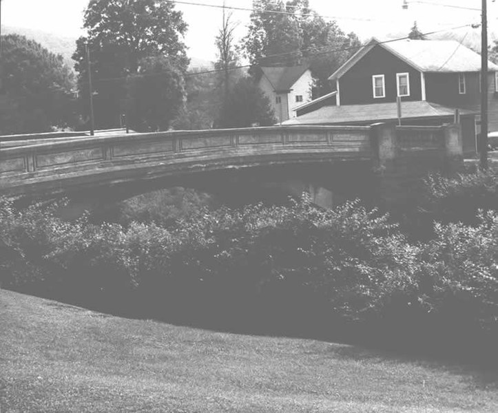
This is an image of a place or building that is listed on the National Register of Historic Places in the United States of America. Its reference number is 88000736. |
| Camera location | | View this and other nearby images on: OpenStreetMap |
|---|
| Description |
English: Side of the Bridge in Westover Borough, which carries Legislative Route 17003/Township Route 185 over Chest Creek in Westover, Pennsylvania, United States. Built in 1917, this open spandrel concrete arch bridge is listed on the National Register of Historic Places. |
|||
| Date | ||||
| Source | "Bridge in Westover Borough" (National Register of Historic Places form). National Park Service (June 22, 1988). Photo from http://www.arch.state.pa.us, searchable database, at http://www.arch.state.pa.us/images/hires/H000121_01B.jpg | |||
| Author | PennDOT | |||
| Permission (Reusing this file) |
|

File history
Click on a date/time to view the file as it appeared at that time.
| Date/Time | Thumbnail | Dimensions | User | Comment | |
|---|---|---|---|---|---|
| current | 04:10, 21 December 2009 | | 764 × 634 (46 KB) | Nyttend (talk | contribs) | {{Location|40|45|9|N|78|40|3|W}} {{Information |Description={{en|Side of the {{w|Bridge in Westover Borough}}, which carries Legislative Route 17003/Township Route 185 over {{w|Chest Creek}} in {{w|Westover, Pennsylvania|Westover}}, {{w|Pennsylvania}}, {{ |
You cannot overwrite this file.
File usage on Commons
The following page uses this file:
File usage on other wikis
The following other wikis use this file:
- Usage on ar.wikipedia.org
- Usage on azb.wikipedia.org
- Usage on ca.wikipedia.org
- Usage on ceb.wikipedia.org
- Usage on ce.wikipedia.org
- Usage on cy.wikipedia.org
- Usage on en.wikipedia.org
- Usage on es.wikipedia.org
- Usage on eu.wikipedia.org
- Usage on fr.wikipedia.org
- Usage on ht.wikipedia.org
- Usage on it.wikipedia.org
- Usage on lld.wikipedia.org
- Usage on pt.wikipedia.org
- Usage on sr.wikipedia.org
- Usage on sv.wikipedia.org
- Usage on tl.wikipedia.org
- Usage on tt.wikipedia.org
- Usage on uk.wikipedia.org
- Usage on uz.wikipedia.org
- Usage on vi.wikipedia.org
- Usage on www.wikidata.org
- Usage on zh-min-nan.wikipedia.org
Metadata
Categories:
- Photographs by Pennsylvania Department of Transportation
- Concrete deck arch bridges in Pennsylvania
- 1910s bridges in Pennsylvania
- Built in Pennsylvania in 1917
- Bridges in the United States completed in 1917
- National Register of Historic Places in Clearfield County, Pennsylvania
- Bridges on the National Register of Historic Places in Pennsylvania
- Bridges in Clearfield County, Pennsylvania
- Westover, Pennsylvania