File:Bridenbaugh District No. 3 Schoolhouse, southern side.jpg
Jump to navigation
Jump to search

Size of this preview: 800 × 600 pixels. Other resolutions: 320 × 240 pixels | 640 × 480 pixels | 1,024 × 768 pixels | 1,280 × 960 pixels | 2,560 × 1,920 pixels | 2,816 × 2,112 pixels.
Original file (2,816 × 2,112 pixels, file size: 2.45 MB, MIME type: image/jpeg)
Captions
Captions
Add a one-line explanation of what this file represents
|
This is an image of a place or building that is listed on the National Register of Historic Places in the United States of America. Its reference number is 5000343. |
| Camera location | | View this and other nearby images on: OpenStreetMap |
|---|
| Description |
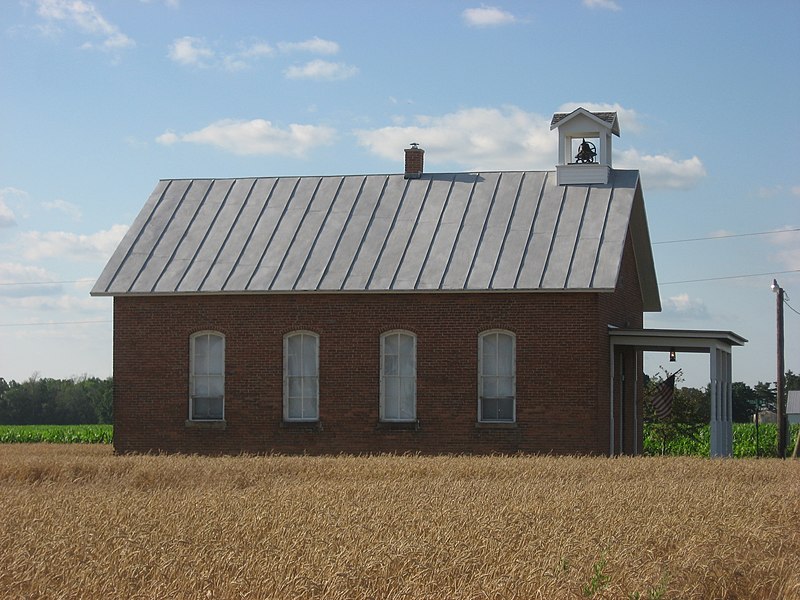
English: Southern side of the Bridenbaugh District No. 3 Schoolhouse, located on the southwestern corner of the intersection of Roads 6 and M-6 north of Pandora in Riley Township, Putnam County, Ohio, United States. Built in 1889, it is listed on the National Register of Historic Places. |
||
| Date | Taken on 24 June 2010 | ||
| Source | Own work | ||
| Author | Nyttend | ||
| Permission (Reusing this file) |
|
File history
Click on a date/time to view the file as it appeared at that time.
| Date/Time | Thumbnail | Dimensions | User | Comment | |
|---|---|---|---|---|---|
| current | 16:52, 25 June 2010 | | 2,816 × 2,112 (2.45 MB) | Nyttend (talk | contribs) | {{Location|41|58|40|N|83|58|37|W}} {{Information |Description={{en|Southern side of the {{w|Bridenbaugh District No. 3 Schoolhouse}}, located on the southwestern corner of the intersection of Roads 6 and M-6 north of {{w|Pandora, Ohio|Pandora}} in {{w|Ril |
You cannot overwrite this file.
File usage on Commons
The following page uses this file:
File usage on other wikis
The following other wikis use this file:
- Usage on en.wikipedia.org
- Usage on es.wikipedia.org
- Usage on eu.wikipedia.org
- Usage on fa.wikipedia.org
- Usage on pt.wikipedia.org
- Usage on vi.wikipedia.org
- Usage on www.wikidata.org
- Usage on zh.wikipedia.org